|
search place name
|
||
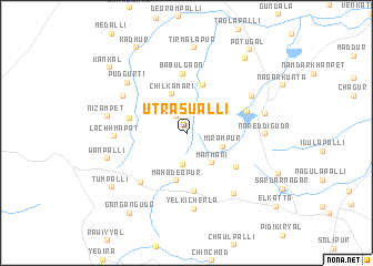
Utrasualli (Andhra Pradesh, India)Utrasualli is a town in the Andhra Pradesh region of India. An overview map of the region around Utrasualli is displayed below.
regional and 3d topo map of Utrasualli, India ::
Utrasualli airports ::
The nearest airport is HYD - Hyderabad, located 53.8 km north east of Utrasualli.
Other airports nearby include BEP - Bellary (253.7 km south west), Nearby towns ::
Mutupur (2.1km north west) //
Byrampalli (3.2km south) //
Mirāmpur (3.7km east) //
Manmari (3.8km south east) //
Chilkamāri (4.1km north) //
Mahadeopur (4.9km south) //
Galūrguda (5.1km north) //
Chinna Umetāl (5.6km west) //
Srīrangapur (5.9km south) //
Bodampahād (5.8km south east) //
Babūlgaon (6.0km north) //
Shāhābād (6.1km east) //
Kondurg (6.6km south west) //
Lachhmapat (6.9km west) //
Chintafpalli (7.1km north west) //
Mudoemgudam (7.3km north east) //
Yelkicherla (7.6km south) //
Mughalgidda (7.6km south east) //
Pudgurti (7.6km north west) //
Nāreddiguda (7.6km east) //
Kummarguda (7.8km east) //
Nizāmpet (7.9km west) //
Wanpalli (7.9km west) //
Tirmalāpur (8.5km north) //
Tumpalli (9.0km south west) //
Sitārāmpur (9.4km north east) //
Ganganguda (9.7km south west) //
Kadmūr (9.8km north west) //
Kankal (9.9km north west) //
[all distances 'as the bird flies' and approximate]  Places with similar names to Utrasualli, India ::
// Uttar Salua (BD)
// Uttar Sāl (IN)
Disclaimer :: Information on this page comes without warranty of any kind |
||
|
Where is Utrasualli? Elevation and coordinates ::
Latitude (lat): 17°8'36"N Longitude (lon): 78°4'41"E
Elevation (approx.): 649m (map arrows pan, magnifying glasses zoom) |
||
|
Visiting Utrasualli? Hotel/Accommodation ::
Book a hotel in Utrasualli Travel Guide ::
Buy a travel guide for India rental cars ::
car rental offers GPS waypoint ::
download a GPX waypoint (PoI) of Utrasualli for your GPS receiver
|
||