|
search place name
|
||
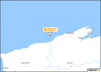
Binigit (Indonesia)Binigit is a town in Indonesia. An overview map of the region around Binigit is displayed below.
regional and 3d topo map of Binigit, Indonesia ::
Binigit airports ::
The nearest airport is SOQ - Sorong Jefman, located 35.7 km south west of Binigit.
Nearby towns ::
Seleber (7.4km east) //
[all distances 'as the bird flies' and approximate]  Places with similar names to Binigit, Indonesia ::
// Banged (PH)
// Bungeţi (RO)
// Bungeţoaia (RO)
// Bungetu (RO)
// Bongide (CD)
// Binjeita (ID)
// Banjot (PK)
// Bin Jawwād (LY)
// Ban Ngét (LA)
// Benegida (ES)
Disclaimer :: Information on this page comes without warranty of any kind |
||
|
Where is Binigit? Elevation and coordinates ::
Latitude (lat): 0°46'0"S Longitude (lon): 131°24'0"E
Elevation (approx.): -32768m (map arrows pan, magnifying glasses zoom) |
||
|
Visiting Binigit? Hotel/Accommodation ::
Book a hotel in Binigit Travel Guide ::
Buy a travel guide for Indonesia rental cars ::
car rental offers GPS waypoint ::
download a GPX waypoint (PoI) of Binigit for your GPS receiver
|
||