|
search place name
|
||
Boboroan (Nusa Tenggara Timur, Indonesia)Boboroan is a town in the Nusa Tenggara Timur region of Indonesia. An overview map of the region around Boboroan is displayed below.
regional and 3d topo map of Boboroan, Indonesia ::

Boboroan airports ::
The nearest airport is DIL - Dili Presidente Nicolau Lobato Intl, located 104.0 km north east of Boboroan.
Nearby towns ::
Besakoan (0.6km north) //
Oenitas (1.0km south) //
Baokono (3.1km east) //
Saknati (3.2km north) //
Mankita (3.4km north) //
Fatuoni (4.0km north) //
Nekus (4.2km north west) //
Nunekat (4.2km north west) //
Kehilran (4.6km north) //
Kotapon (4.5km west) //
Manune (4.6km north east) //
Oekui (4.7km south west) //
Ukui (4.6km south west) //
Hasfuik (4.7km north east) //
Fatukonedok (4.9km north east) //
Maubesi (5.4km north) //
Benai (5.7km north east) //
Oekoro (6.2km west) //
Hofehan (6.6km east) //
Oenari (6.9km south east) //
Antonifui (7.2km north west) //
Obokin (7.3km north east) //
Selowai (7.5km north) //
Rotiklot (7.6km north east) //
Nera (7.7km north east) //
Oepauk (8.0km south west) //
Tabean (8.0km east) //
Ainiba (8.4km north east) //
Oemoke (8.6km east) //
[all distances 'as the bird flies' and approximate] 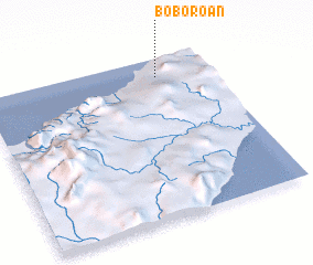 Places with similar names to Boboroan, Indonesia ::
Disclaimer :: Information on this page comes without warranty of any kind |
||
|
Where is Boboroan? Elevation and coordinates ::
Latitude (lat): 9°6'47"S Longitude (lon): 124°46'12"E
Elevation (approx.): 42m (map arrows pan, magnifying glasses zoom) |
||
|
Visiting Boboroan? Hotel/Accommodation ::
Book a hotel in Boboroan Travel Guide ::
Buy a travel guide for Indonesia rental cars ::
car rental offers GPS waypoint ::
download a GPX waypoint (PoI) of Boboroan for your GPS receiver
|
||