|
search place name
|
||
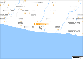
Cipandak (Indonesia)Cipandak is a town in Indonesia. An overview map of the region around Cipandak is displayed below.
regional and 3d topo map of Cipandak, Indonesia ::
Cipandak airports ::
The nearest airport is CGK - Jakarta Soekarno Hatta Intl, located 165.4 km north west of Cipandak.
Nearby towns ::
Bungbulangkoneng (4.1km north west) //
Cijambu (5.2km north east) //
Cikamurang (5.5km west) //
Ciodeng (6.7km north west) //
Cidaun (7.4km east) //
Bojongjengkol (9.2km north west) //
Ciogong (9.2km north east) //
Badodonsuta (10.4km north west) //
[all distances 'as the bird flies' and approximate] 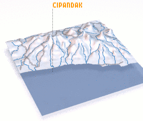 Places with similar names to Cipandak, Indonesia ::
// Cipandak (ID)
// Cipeundeuy 2 (ID)
// Cipondok (ID)
// Cipondok (ID)
// Cipondok (ID)
// Spantekow (DE)
// Spina Takka (PK)
// Spīn Takai (PK)
// Spīn Tak (AF)
// Spanidiga (HR)
Disclaimer :: Information on this page comes without warranty of any kind |
||
|
Where is Cipandak? Elevation and coordinates ::
Latitude (lat): 7°29'0"S Longitude (lon): 107°17'0"E
Elevation (approx.): 22m (map arrows pan, magnifying glasses zoom) |
||
|
Visiting Cipandak? Hotel/Accommodation ::
Book a hotel in Cipandak Travel Guide ::
Buy a travel guide for Indonesia rental cars ::
car rental offers GPS waypoint ::
download a GPX waypoint (PoI) of Cipandak for your GPS receiver
|
||