|
search place name
|
||
Cipelang (Indonesia)Cipelang is a town in Indonesia. An overview map of the region around Cipelang is displayed below.
regional and 3d topo map of Cipelang, Indonesia ::

Cipelang airports ::
The nearest airport is CGK - Jakarta Soekarno Hatta Intl, located 169.9 km north west of Cipelang.
Nearby towns ::
Babakan Asem (2.6km south west) //
Combong (3.7km west) //
Ujungjaya (4.1km north east) //
Ungko (4.1km north west) //
Ciawi (5.6km north) //
Bugel (5.9km south) //
Cijelag (6.7km south east) //
Babakan Gebang (7.4km north) //
Conggeang (7.4km west) //
Marluk (7.6km east) //
Cibuluh (7.6km north) //
Keboncau (7.6km east) //
Cibodas 2 (7.7km west) //
Nyalindung (7.8km south west) //
Tomo (8.2km south east) //
Kebonklapa (8.2km south west) //
Narimbang (9.0km west) //
Sempurakalo (9.1km west) //
Warungkreo (9.6km south west) //
[all distances 'as the bird flies' and approximate] 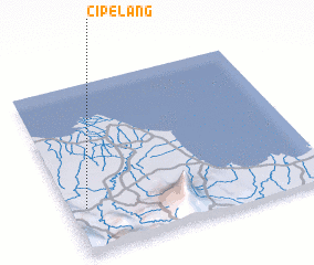 Places with similar names to Cipelang, Indonesia ::
// Spelonca (IT)
// Spólnik (PL)
// Zaplanik (BA)
// Ceplenieki (LV)
// Şpălnaca (RO)
// Sapelang (ID)
// Sipulung (ID)
// Sipal Nakka (PK)
// Sapallanga (PE)
// Spilinga (IT)
Disclaimer :: Information on this page comes without warranty of any kind |
||
|
Where is Cipelang? Elevation and coordinates ::
Latitude (lat): 6°44'0"S Longitude (lon): 108°4'0"E
Elevation (approx.): 118m (map arrows pan, magnifying glasses zoom) |
||
|
Visiting Cipelang? Hotel/Accommodation ::
Book a hotel in Cipelang Travel Guide ::
Buy a travel guide for Indonesia rental cars ::
car rental offers GPS waypoint ::
download a GPX waypoint (PoI) of Cipelang for your GPS receiver
|
||