|
search place name
|
||
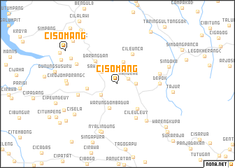
Cisomang (Indonesia)Cisomang is a town in Indonesia. An overview map of the region around Cisomang is displayed below.
regional and 3d topo map of Cisomang, Indonesia ::
Cisomang airports ::
The nearest airport is CGK - Jakarta Soekarno Hatta Intl, located 110.1 km north west of Cisomang.
Nearby towns ::
Nangewe (1.9km north east) //
Pangkalan (3.0km east) //
Cikalong Wetan (3.1km south west) //
Sawicibitung (3.2km north west) //
Cilingga (3.6km north) //
Warungdomba Dua (4.0km south) //
Dangdeur tonggoh (4.8km west) //
Darangdan (5.0km north west) //
Pangheotan (5.1km south east) //
Cileunca (5.3km north east) //
Cileuleuy (6.2km south east) //
Rendeh (6.5km west) //
Depok (6.7km east) //
Cikeris 2 (7.0km east) //
Depok (7.3km north west) //
Dano (7.5km south east) //
Sasaksaat (8.0km south) //
Nyalindung (8.0km south) //
Cikadongdong (8.1km west) //
Cirojomporang 2 (8.2km west) //
Cisela (8.4km south west) //
Nangtang (8.4km north west) //
Sindok 1 (8.6km east) //
Tajur (8.9km east) //
Cilangkap Dua (9.5km south west) //
Pondokbungur (9.8km north east) //
Cibogohilir 2 (9.9km north west) //
Cisomang (9.8km north west) //
Ciraja (10.0km south west) //
[all distances 'as the bird flies' and approximate] 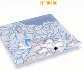 Places with similar names to Cisomang, Indonesia ::
// Szuminka (PL)
// Szymanki (PL)
// Szymanówka (PL)
// Szymanówka (PL)
// Szymonka (PL)
// Szymonki (PL)
// Sasimanga (MG)
// Sasimanga (MG)
// Cisomang (ID)
Disclaimer :: Information on this page comes without warranty of any kind |
||
|
Where is Cisomang? Elevation and coordinates ::
Latitude (lat): 6°43'3"S Longitude (lon): 107°27'23"E
Elevation (approx.): 689m (map arrows pan, magnifying glasses zoom) |
||
|
Visiting Cisomang? Hotel/Accommodation ::
Book a hotel in Cisomang Travel Guide ::
Buy a travel guide for Indonesia rental cars ::
car rental offers GPS waypoint ::
download a GPX waypoint (PoI) of Cisomang for your GPS receiver
|
||