|
search place name
|
||
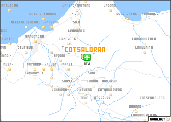
Cotsaloran (Indonesia)Cotsaloran is a town in Indonesia. An overview map of the region around Cotsaloran is displayed below.
regional and 3d topo map of Cotsaloran, Indonesia ::
Cotsaloran airports ::
The nearest airport is BTJ - Banda Aceh Sultan Iskandarmuda, located 0.9 km north east of Cotsaloran.
Nearby towns ::
Lamteumeureue (2.6km north east) //
Timpoh (4.1km north west) //
Datadaroi (4.1km south east) //
Sumet (4.1km south east) //
Paret (4.1km south west) //
Lamnyong (5.2km north west) //
Stroni (5.5km west) //
Tubane (5.9km south) //
Leupueng (5.9km north) //
Aron (5.9km north) //
Sibree (6.7km south west) //
Piyeueng (7.4km south) //
Siem (7.6km north) //
Luengbata (7.6km west) //
Kaluet (7.6km west) //
Montasik (7.8km south east) //
Delieb (8.3km south west) //
Lambukong (8.3km south west) //
Lambirah (9.3km south west) //
Eumeetrieng (9.2km south west) //
Cotbakarieng (9.3km south east) //
Lamnyong (10.5km north west) //
Ujungkrueng (10.5km north west) //
[all distances 'as the bird flies' and approximate] 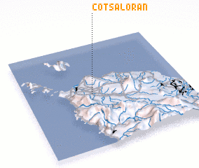 Places with similar names to Cotsaloran, Indonesia :: Disclaimer :: Information on this page comes without warranty of any kind |
||
|
Where is Cotsaloran? Elevation and coordinates ::
Latitude (lat): 5°31'0"N Longitude (lon): 95°25'0"E
Elevation (approx.): 20m (map arrows pan, magnifying glasses zoom) |
||
|
Visiting Cotsaloran? Hotel/Accommodation ::
Book a hotel in Cotsaloran Travel Guide ::
Buy a travel guide for Indonesia rental cars ::
car rental offers GPS waypoint ::
download a GPX waypoint (PoI) of Cotsaloran for your GPS receiver
|
||