|
search place name
|
||
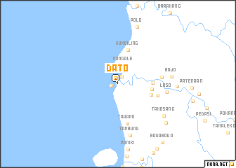
Dato (Sulawesi Selatan, Indonesia)Dato is a town in the Sulawesi Selatan region of Indonesia. An overview map of the region around Dato is displayed below.
regional and 3d topo map of Dato, Indonesia ::
Dato airports ::
The nearest airport is PLW - Palu Mutiara, located 177.2 km north east of Dato.
Other airports nearby include PSJ - Poso Kasiguncu (197.1 km north east), Nearby towns ::
Karama (1.1km west) //
Sampaga (1.3km north east) //
Pangale (3.1km north) //
Sidal (5.5km east) //
Tarailu (5.5km east) //
Mariri (5.5km east) //
Kumbiling (5.6km north) //
Tawaro (6.5km south) //
Bulucengkeh (6.6km east) //
Alangalong (7.0km east) //
Loso (7.8km east) //
Tambung (8.5km south) //
Bajo (8.6km east) //
Takosang (8.9km south east) //
Baru (9.8km south east) //
[all distances 'as the bird flies' and approximate] 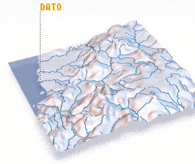 Places with similar names to Dato, Indonesia ::
Disclaimer :: Information on this page comes without warranty of any kind |
||
|
Where is Dato? Elevation and coordinates ::
Latitude (lat): 2°18'50"S Longitude (lon): 119°7'35"E
(map arrows pan, magnifying glasses zoom) |
||
|
Visiting Dato? Hotel/Accommodation ::
Book a hotel in Dato Travel Guide ::
Buy a travel guide for Indonesia rental cars ::
car rental offers GPS waypoint ::
download a GPX waypoint (PoI) of Dato for your GPS receiver
|
||