|
search place name
|
||
Fatuatis (Nusa Tenggara Timur, Indonesia)Fatuatis is a town in the Nusa Tenggara Timur region of Indonesia. An overview map of the region around Fatuatis is displayed below.
regional and 3d topo map of Fatuatis, Indonesia ::

Fatuatis airports ::
The nearest airport is DIL - Dili Presidente Nicolau Lobato Intl, located 91.8 km north east of Fatuatis.
Nearby towns ::
Umarese (0.2km north) //
Wesasuit (0.7km east) //
Lafahin (1.1km north west) //
Lakariterai (1.4km west) //
Lakaikiri (1.4km west) //
Lakatean (1.5km south west) //
Halimea (1.7km south west) //
Selala (1.8km south) //
Sarigunung (2.1km south west) //
Weturukartolo (2.2km north west) //
Fatumalai (2.6km south west) //
Fukalaran (2.8km west) //
Banfanu (3.1km south east) //
Barluli (3.3km north) //
Namonulun (3.5km north east) //
Fatukeduak (3.8km north) //
Atapupu (4.0km north) //
Raikatar (4.0km north) //
Sambiku (4.0km south) //
Ainiba (4.2km south west) //
Berluli (4.2km north west) //
Kakuban (4.3km east) //
Fatuluka (4.4km north) //
Wehor (4.5km east) //
Afui (4.5km north west) //
Fatukorat (4.7km east) //
Fatuala (4.9km north) //
Nera (5.0km south west) //
Rotiklot (5.0km south west) //
[all distances 'as the bird flies' and approximate] 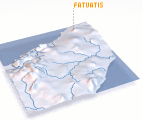 Places with similar names to Fatuatis, Indonesia ::
Disclaimer :: Information on this page comes without warranty of any kind |
||
|
Where is Fatuatis? Elevation and coordinates ::
Latitude (lat): 9°2'8"S Longitude (lon): 124°51'0"E
Elevation (approx.): 45m (map arrows pan, magnifying glasses zoom) |
||
|
Visiting Fatuatis? Hotel/Accommodation ::
Book a hotel in Fatuatis Travel Guide ::
Buy a travel guide for Indonesia rental cars ::
car rental offers GPS waypoint ::
download a GPX waypoint (PoI) of Fatuatis for your GPS receiver
|
||