|
search place name
|
||
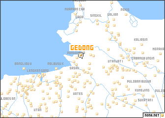
Gedong (Jawa Barat, Indonesia)Gedong is a town in the Jawa Barat region of Indonesia. An overview map of the region around Gedong is displayed below.
regional and 3d topo map of Gedong, Indonesia ::
Gedong airports ::
The nearest airport is CGK - Jakarta Soekarno Hatta Intl, located 42.7 km west of Gedong.
Nearby towns ::
Pondokdua (1.3km west) //
Sembilangan (1.9km south west) //
Rawagunda (1.9km south east) //
Sungaipesusung (2.0km west) //
Teluklombangan (2.0km north east) //
Pondoktengah (2.3km north) //
Sungaitotok (2.5km south) //
Pondoksoga (2.7km south east) //
Tanjung (2.6km east) //
Cabangampat (3.0km south) //
Bintaro (3.3km south) //
Sasak (3.6km south west) //
Singkil (3.6km south) //
Muara (3.9km south east) //
Cabanggelam (4.2km south) //
Telar (4.4km south west) //
Boni (5.1km south) //
Genting (5.1km east) //
Karatan (5.2km south) //
Kramat (5.3km south) //
Kerangkeng (5.5km south) //
Kebonkelapa (5.6km south west) //
Kelapa (5.6km south west) //
Kampungutan (5.7km south) //
Sungaitawar (5.7km south west) //
Kedungringin (6.1km south east) //
Cabangdua Satu (6.2km east) //
Tambun-rawasalak (6.3km south) //
Palbusuk (6.3km west) //
[all distances 'as the bird flies' and approximate] 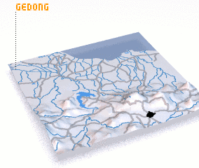 Places with similar names to Gedong, Indonesia ::
Disclaimer :: Information on this page comes without warranty of any kind |
||
|
Where is Gedong? Elevation and coordinates ::
Latitude (lat): 6°3'48"S Longitude (lon): 107°2'13"E
Elevation (approx.): 1m (map arrows pan, magnifying glasses zoom) |
||
|
Visiting Gedong? Hotel/Accommodation ::
Book a hotel in Gedong Travel Guide ::
Buy a travel guide for Indonesia rental cars ::
car rental offers GPS waypoint ::
download a GPX waypoint (PoI) of Gedong for your GPS receiver
|
||