|
search place name
|
||
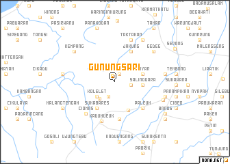
Gunungsari (Indonesia)Gunungsari is a town in Indonesia. An overview map of the region around Gunungsari is displayed below.
regional and 3d topo map of Gunungsari, Indonesia ::
Gunungsari airports ::
The nearest airport is CGK - Jakarta Soekarno Hatta Intl, located 66.1 km east of Gunungsari.
Nearby towns ::
Sudimampir (1.5km north east) //
Ciherang (2.6km south west) //
Bojong (2.7km east) //
Gunungkupak (3.7km south west) //
Kolelet (3.8km south west) //
Salinggara (4.5km east) //
Sayar (4.6km east) //
Pabuwaran 3 (5.1km south east) //
Sukabares (5.2km south west) //
Jakung (5.6km north east) //
Cipait (6.2km south) //
Paleuh (6.2km south east) //
Kadumueuk (6.8km south) //
Ciomas (7.0km south west) //
Taktakan (7.3km north) //
Gedeg (8.0km north east) //
Balagendong (8.2km north east) //
Kepuh (8.2km east) //
Kempang (8.3km north west) //
Rancalutung (8.3km east) //
Calincing (8.5km east) //
Bojongjuruh (8.5km west) //
Panakodan (9.2km north) //
Malangtengah (9.5km south west) //
Baros (9.6km south east) //
Oteng (10.2km south east) //
Taman (10.7km north east) //
Pasirwaru (12.1km north west) //
Mancak (12.1km north west) //
[all distances 'as the bird flies' and approximate] 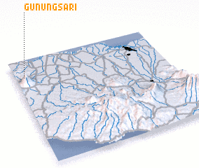 Places with similar names to Gunungsari, Indonesia ::
// Gunungsari (ID)
// Gunungsari (ID)
// Gunungsari (ID)
// Gunungsari (ID)
// Gunungsari (ID)
// Gunungsari (ID)
// Gunungsari (ID)
// Gunungsari (ID)
// Kaniungsari (ID)
Disclaimer :: Information on this page comes without warranty of any kind |
||
|
Where is Gunungsari? Elevation and coordinates ::
Latitude (lat): 6°9'42"S Longitude (lon): 106°3'35"E
Elevation (approx.): 210m (map arrows pan, magnifying glasses zoom) |
||
|
Visiting Gunungsari? Hotel/Accommodation ::
Book a hotel in Gunungsari Travel Guide ::
Buy a travel guide for Indonesia rental cars ::
car rental offers GPS waypoint ::
download a GPX waypoint (PoI) of Gunungsari for your GPS receiver
|
||