|
search place name
|
||
Gurungsang (Indonesia)Gurungsang is a town in Indonesia. An overview map of the region around Gurungsang is displayed below.
regional and 3d topo map of Gurungsang, Indonesia ::

Gurungsang airports ::
The nearest airport is CGK - Jakarta Soekarno Hatta Intl, located 98.5 km north west of Gurungsang.
Nearby towns ::
Ciharashas (2.4km north west) //
Warungkuah (2.7km north) //
Cikumpay (2.9km east) //
Cibungur 1 (3.1km north) //
Babakan Ciharashas (3.6km north west) //
Tegalseureuh (3.9km west) //
Sindangsari (3.9km east) //
Munjul 1 (3.9km south) //
Cempaka (4.1km south east) //
Cikadu (4.9km north east) //
Sadang (4.9km south west) //
Pasarsenen (5.2km south west) //
Chodong (5.4km north) //
Citalang 2 (5.5km south) //
Maracang-tua (5.6km south west) //
Nagrok (6.4km east) //
Cimahi 2 (6.4km north east) //
Cigombrong (6.9km south west) //
Cinangka (7.0km north) //
Cikaobandung 1 (6.9km west) //
Kamojing (7.1km north) //
Cikopo 1 (7.2km north) //
Pasirmalang (7.2km east) //
Purwakarta (7.6km south west) //
Nagrok (7.7km west) //
Cibatu 1 (7.7km east) //
Jatiluhur (8.2km south west) //
Sayangheulang (8.2km south west) //
Pangkalan (8.3km south east) //
[all distances 'as the bird flies' and approximate] 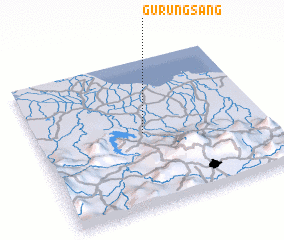
Disclaimer :: Information on this page comes without warranty of any kind |
||
|
Where is Gurungsang? Elevation and coordinates ::
Latitude (lat): 6°29'41"S Longitude (lon): 107°27'59"E
Elevation (approx.): 84m (map arrows pan, magnifying glasses zoom) |
||
|
Visiting Gurungsang? Hotel/Accommodation ::
Book a hotel in Gurungsang Travel Guide ::
Buy a travel guide for Indonesia rental cars ::
car rental offers GPS waypoint ::
download a GPX waypoint (PoI) of Gurungsang for your GPS receiver
|
||