|
search place name
|
||
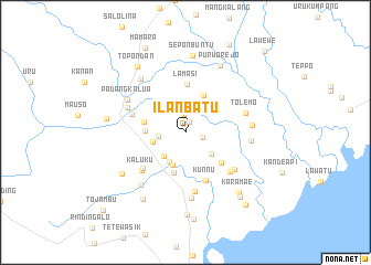
Ilanbatu (Sulawesi Selatan, Indonesia)Ilanbatu is a town in the Sulawesi Selatan region of Indonesia. An overview map of the region around Ilanbatu is displayed below.
regional and 3d topo map of Ilanbatu, Indonesia ::
Ilanbatu airports ::
The nearest airport is PSJ - Poso Kasiguncu, located 168.7 km north of Ilanbatu.
Other airports nearby include PLW - Palu Mutiara (217.0 km north), Nearby towns ::
Panggoli (1.2km north) //
Rantedamai (1.8km east) //
Harapan (1.9km north) //
Saragi (2.8km west) //
Karetan (3.2km south west) //
Buntubuku (3.3km south west) //
Panilangkan (3.4km south east) //
Bolukanna (3.4km west) //
Lekong (3.5km south) //
Seriti (3.7km north east) //
Maendopantilang (4.1km west) //
Gerumbul (4.1km north east) //
Tumaraja (4.3km south) //
Uraso (4.4km west) //
Poppoko (4.8km south east) //
Lamasi (4.9km north) //
Kunnu (5.3km south east) //
Padanglipan (5.6km south west) //
Walenrang (5.7km west) //
Kaluku (5.9km south west) //
Salubatang (6.0km south east) //
Batu (6.1km south) //
Wailempa (6.3km south east) //
Padangdurian (6.4km north west) //
Tolemo (6.4km east) //
Palangiran (6.6km south) //
Tokaili (6.7km east) //
Padangkalua (6.7km north west) //
Sinangkala (6.7km east) //
[all distances 'as the bird flies' and approximate] 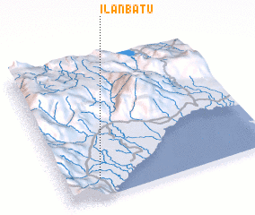 Places with similar names to Ilanbatu, Indonesia :: Disclaimer :: Information on this page comes without warranty of any kind |
||
|
Where is Ilanbatu? Elevation and coordinates ::
Latitude (lat): 2°51'46"S Longitude (lon): 120°10'29"E
Elevation (approx.): 37m (map arrows pan, magnifying glasses zoom) |
||
|
Visiting Ilanbatu? Hotel/Accommodation ::
Book a hotel in Ilanbatu Travel Guide ::
Buy a travel guide for Indonesia rental cars ::
car rental offers GPS waypoint ::
download a GPX waypoint (PoI) of Ilanbatu for your GPS receiver
|
||