|
search place name
|
||
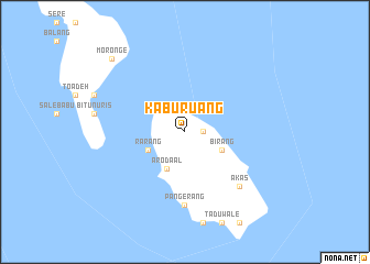
Kaburuang (Indonesia)Kaburuang is a town in Indonesia. An overview map of the region around Kaburuang is displayed below.
regional and 3d topo map of Kaburuang, Indonesia ::
Kaburuang airports ::
The nearest airport is OTI - Morotai Island Pitu, located 261.6 km south east of Kaburuang.
Nearby towns ::
Pantuge (1.8km east) //
Rarang (4.1km south west) //
Bulude (4.1km south west) //
Mangarang (4.1km south west) //
Arodaal (4.1km south west) //
Birang (4.1km south east) //
Pangerang (7.4km south) //
Akas (7.9km south east) //
Moronge (10.5km north west) //
[all distances 'as the bird flies' and approximate]  Places with similar names to Kaburuang, Indonesia ::
// Kobierniki (PL)
// Kobierniki (PL)
// Kabernik (BA)
// Gbèrankou (BJ)
// Gberniki (BJ)
// Gabarnac (FR)
// Gbarnga (LR)
// Gabrnik (SI)
// Quiburungo (AO)
Disclaimer :: Information on this page comes without warranty of any kind |
||
|
Where is Kaburuang? Elevation and coordinates ::
Latitude (lat): 3°50'0"N Longitude (lon): 126°47'0"E
Elevation (approx.): 54m (map arrows pan, magnifying glasses zoom) |
||
|
Visiting Kaburuang? Hotel/Accommodation ::
Book a hotel in Kaburuang Travel Guide ::
Buy a travel guide for Indonesia rental cars ::
car rental offers GPS waypoint ::
download a GPX waypoint (PoI) of Kaburuang for your GPS receiver
|
||