|
search place name
|
||
Kampunglama (Nusa Tenggara Timur, Indonesia)Kampunglama is a town in the Nusa Tenggara Timur region of Indonesia. An overview map of the region around Kampunglama is displayed below.
regional and 3d topo map of Kampunglama, Indonesia ::

Kampunglama airports ::
The nearest airport is DIL - Dili Presidente Nicolau Lobato Intl, located 215.0 km north east of Kampunglama.
Nearby towns ::
Berdikari (0.7km south) //
Fatufeto (0.8km east) //
Naikliu (1.1km east) //
Kisba (1.5km east) //
Taheba (1.6km east) //
Noemeto (1.7km east) //
Noetoko (2.3km south east) //
Kapuktulis (2.3km north west) //
Bitlau (2.3km north east) //
Kiulopon (2.6km north east) //
Masakgaram (2.8km north east) //
Poabas (3.0km east) //
Upuana (3.4km east) //
Kisba Dua (3.7km east) //
Kisba Tiga (4.6km east) //
Oelkail (5.1km north east) //
Oelkaka (5.4km east) //
Fatumtasak (5.5km east) //
Poti (7.9km south west) //
Soliu (8.4km south west) //
Nainunus (9.0km north east) //
Naekim (10.3km south west) //
Manufui (10.4km south west) //
Hunael (10.6km south west) //
Bilaos (10.6km north east) //
Poabas (11.1km south west) //
[all distances 'as the bird flies' and approximate] 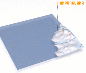 Places with similar names to Kampunglama, Indonesia ::
// Kampong Lama (MY)
// Kampong Lama (MY)
// Kampong Lama (MY)
// Kampong Lembah (MY)
// Kampong Lembah (MY)
// Kampong Lembah (MY)
// Kampong Lembah (MY)
// Kampong Lembah (MY)
// Kampong Lembah (MY)
// Kampong Lembu (MY)
Disclaimer :: Information on this page comes without warranty of any kind |
||
|
Where is Kampunglama? Elevation and coordinates ::
Latitude (lat): 9°29'59"S Longitude (lon): 123°49'12"E
Elevation (approx.): 16m (map arrows pan, magnifying glasses zoom) |
||
|
Visiting Kampunglama? Hotel/Accommodation ::
Book a hotel in Kampunglama Travel Guide ::
Buy a travel guide for Indonesia rental cars ::
car rental offers GPS waypoint ::
download a GPX waypoint (PoI) of Kampunglama for your GPS receiver
|
||