|
search place name
|
||
Karanggede (Jawa Tengah, Indonesia)Karanggede is a town in the Jawa Tengah region of Indonesia. An overview map of the region around Karanggede is displayed below.
regional and 3d topo map of Karanggede, Indonesia ::

Nearby towns ::
Blimbing (2.7km north) //
Ngablak (5.0km south east) //
Klego (5.1km east) //
Bakalrejo (6.1km south west) //
Bonomerto (6.3km west) //
Ngankruk (6.7km east) //
Semagu (6.9km south west) //
Wonosegoro (7.1km north east) //
Bandung (7.4km north) //
Susukan (7.5km south west) //
Suruh (7.7km west) //
Tegalrejo (8.4km east) //
Kedungtengkong (8.7km south east) //
Sumberrejo (8.9km west) //
Simo (9.3km south east) //
Bulu (9.3km north west) //
Ngenjer (9.4km north west) //
Timpik (9.7km south west) //
Ngroto (9.8km north west) //
Dadapayan (9.8km north west) //
Pucung (11.0km north west) //
[all distances 'as the bird flies' and approximate] 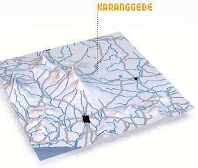 Places with similar names to Karanggede, Indonesia ::
// Corangot (PH)
// Gurengad (PH)
// Korniaktów (PL)
// Karankut (UA)
// Green Gate (US)
// Greengate (US)
// Kaôh Rŭng (3) (KH)
// Krâng Téh (KH)
// Karnākāti (BD)
// Kourangati (TD)
Disclaimer :: Information on this page comes without warranty of any kind |
||
|
Where is Karanggede? Elevation and coordinates ::
Latitude (lat): 7°21'46"S Longitude (lon): 110°38'25"E
Elevation (approx.): 304m (map arrows pan, magnifying glasses zoom) |
||
|
Visiting Karanggede? Hotel/Accommodation ::
Book a hotel in Karanggede Travel Guide ::
Buy a travel guide for Indonesia rental cars ::
car rental offers GPS waypoint ::
download a GPX waypoint (PoI) of Karanggede for your GPS receiver
|
||