|
search place name
|
||
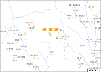
Kawangin (Sulawesi Selatan, Indonesia)Kawangin is a town in the Sulawesi Selatan region of Indonesia. An overview map of the region around Kawangin is displayed below.
regional and 3d topo map of Kawangin, Indonesia ::
Kawangin airports ::
The nearest airport is PSJ - Poso Kasiguncu, located 205.5 km north east of Kawangin.
Nearby towns ::
Lakke (1.2km north) //
Bittuang (2.4km east) //
Neneng (3.3km east) //
Salong (3.3km north east) //
Palian (3.8km south east) //
Palian (3.8km south east) //
Rattekole (5.1km east) //
Binotok (5.6km east) //
Binotok (5.6km east) //
Tambolang (6.0km south east) //
Balombong (6.5km south east) //
Rea (6.7km south) //
Bulangi (7.1km north west) //
Pollo (7.3km west) //
Kulayu (8.9km north west) //
Rada (9.6km south west) //
Awan (9.6km north east) //
Ranuang (10.1km south west) //
Karaka (11.9km south west) //
[all distances 'as the bird flies' and approximate]  Places with similar names to Kawangin, Indonesia ::
Disclaimer :: Information on this page comes without warranty of any kind |
||
|
Where is Kawangin? Elevation and coordinates ::
Latitude (lat): 2°58'37"S Longitude (lon): 119°39'15"E
Elevation (approx.): 1335m (map arrows pan, magnifying glasses zoom) |
||
|
Visiting Kawangin? Hotel/Accommodation ::
Book a hotel in Kawangin Travel Guide ::
Buy a travel guide for Indonesia rental cars ::
car rental offers GPS waypoint ::
download a GPX waypoint (PoI) of Kawangin for your GPS receiver
|
||