|
search place name
|
||
Kebonbaru (Indonesia)Kebonbaru is a town in Indonesia. An overview map of the region around Kebonbaru is displayed below.
regional and 3d topo map of Kebonbaru, Indonesia ::

Kebonbaru airports ::
The nearest airport is CGK - Jakarta Soekarno Hatta Intl, located 29.2 km west of Kebonbaru.
Nearby towns ::
Betingan (0.6km south west) //
Song (0.7km east) //
Sawah-baru (0.8km west) //
Tugu (1.0km south east) //
Kurus (1.1km south) //
Terusan (1.2km north) //
Walang (1.2km south west) //
Lagoa (1.3km north west) //
Tugubatutumbu (1.3km south) //
Semper (1.4km east) //
Tipar (1.5km south) //
Bantenan (1.6km north east) //
Sungaibegoh (1.6km east) //
Rawabadak (1.7km west) //
Rawamalang (1.7km south east) //
Rengas (1.7km south) //
Tanahmerdika (1.8km north east) //
Kandang (2.0km south) //
Pedongkelan (2.1km north east) //
Kampungmangga (2.2km south west) //
Kajangan (2.2km south east) //
Kelumpang (2.3km south west) //
Bendunganmelayu (2.4km south) //
Rawagatel (2.7km south) //
Kampungkoja (2.7km west) //
Pejongkoran (2.8km north west) //
Cilincing (2.8km north east) //
Ketapang (2.9km east) //
Tanjung Priok (3.2km west) //
[all distances 'as the bird flies' and approximate] 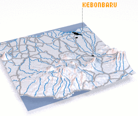 Places with similar names to Kebonbaru, Indonesia ::
Disclaimer :: Information on this page comes without warranty of any kind |
||
|
Where is Kebonbaru? Elevation and coordinates ::
Latitude (lat): 6°7'4"S Longitude (lon): 106°55'11"E
Elevation (approx.): 5m (map arrows pan, magnifying glasses zoom) |
||
|
Visiting Kebonbaru? Hotel/Accommodation ::
Book a hotel in Kebonbaru Travel Guide ::
Buy a travel guide for Indonesia rental cars ::
car rental offers GPS waypoint ::
download a GPX waypoint (PoI) of Kebonbaru for your GPS receiver
|
||