|
search place name
|
||
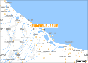
Keudeieleubeue (Indonesia)Keudeieleubeue is a town in Indonesia. An overview map of the region around Keudeieleubeue is displayed below.
regional and 3d topo map of Keudeieleubeue, Indonesia ::
Keudeieleubeue airports ::
The nearest airport is BTJ - Banda Aceh Sultan Iskandarmuda, located 71.1 km west of Keudeieleubeue.
Nearby towns ::
Pasi (0.1km north east) //
Penggaraman (0.9km south) //
Asan Kumbang (3.2km south west) //
Leneang (3.3km south east) //
Iboih (3.7km west) //
Kampung Asan (3.8km south) //
Bungie (4.1km south west) //
Cotjaja (4.1km north west) //
Pasilho (4.1km south east) //
Tambak (4.4km south east) //
Jeumeurang (5.4km south east) //
Mangki (5.8km west) //
Sanget (6.4km south) //
Njong (6.4km south east) //
Kerieng (6.6km south west) //
Beureueh (6.7km south west) //
Beureunun (6.7km south west) //
Sukon (6.7km north west) //
Buhueklaiu (7.4km west) //
Teupin-raya (7.6km south) //
Tanjong (7.7km south) //
Keumangan (8.3km south west) //
Musa (11.1km south east) //
[all distances 'as the bird flies' and approximate]  Places with similar names to Keudeieleubeue, Indonesia ::
Disclaimer :: Information on this page comes without warranty of any kind |
||
|
Where is Keudeieleubeue? Elevation and coordinates ::
Latitude (lat): 5°20'0"N Longitude (lon): 96°2'0"E
Elevation (approx.): -32768m (map arrows pan, magnifying glasses zoom) |
||
|
Visiting Keudeieleubeue? Hotel/Accommodation ::
Book a hotel in Keudeieleubeue Travel Guide ::
Buy a travel guide for Indonesia rental cars ::
car rental offers GPS waypoint ::
download a GPX waypoint (PoI) of Keudeieleubeue for your GPS receiver
|
||