|
search place name
|
||
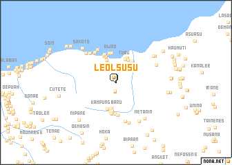
Leolsusu (Nusa Tenggara Timur, Indonesia)Leolsusu is a town in the Nusa Tenggara Timur region of Indonesia. An overview map of the region around Leolsusu is displayed below.
regional and 3d topo map of Leolsusu, Indonesia ::
Leolsusu airports ::
The nearest airport is DIL - Dili Presidente Nicolau Lobato Intl, located 134.6 km north east of Leolsusu.
Nearby towns ::
Leolsusu (0.0km east) //
Leolaes (0.6km north) //
Leolaes (0.6km north) //
Manupono (1.4km south) //
Manupono (1.5km south) //
Laloa (2.1km north) //
Laloa (2.1km north) //
Lakat (2.6km north) //
Lakat (2.6km north) //
Kaleo (3.3km north) //
Noetef (3.9km north) //
Tubu (4.1km north) //
Tubu (4.1km north) //
Usapinasi (4.1km north east) //
Usapinasi (4.1km north east) //
Boenana (4.2km south) //
Temkuna (4.3km north east) //
Sisali (4.3km north east) //
Sisali (4.3km north east) //
Temkuna (4.4km north east) //
Koko (4.5km north) //
Kampungbaru (4.5km south) //
Naikmeko (4.6km south) //
Kabukmina (4.7km north west) //
Bobokase (4.8km south) //
Aijao (4.8km north) //
Aijao (4.9km north) //
Wini (4.9km north) //
Manamas (5.0km south) //
[all distances 'as the bird flies' and approximate] 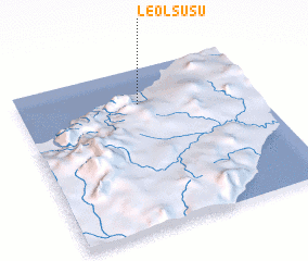 Places with similar names to Leolsusu, Indonesia ::
Disclaimer :: Information on this page comes without warranty of any kind |
||
|
Where is Leolsusu? Elevation and coordinates ::
Latitude (lat): 9°13'21"S Longitude (lon): 124°30'27"E
Elevation (approx.): 79m (map arrows pan, magnifying glasses zoom) |
||
|
Visiting Leolsusu? Hotel/Accommodation ::
Book a hotel in Leolsusu Travel Guide ::
Buy a travel guide for Indonesia rental cars ::
car rental offers GPS waypoint ::
download a GPX waypoint (PoI) of Leolsusu for your GPS receiver
|
||