|
search place name
|
||
Majenang (Indonesia)Majenang is a town in Indonesia. An overview map of the region around Majenang is displayed below.
regional and 3d topo map of Majenang, Indonesia ::
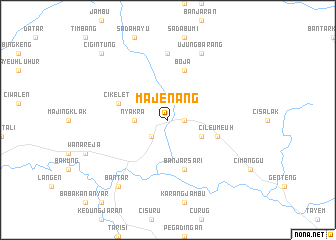
Nearby towns ::
Cilopadang (1.8km east) //
Ponjean (2.6km south west) //
Nyakra (3.7km west) //
Benda (4.1km south east) //
Cikelet (5.8km west) //
Cileumeuh (5.8km east) //
Banjarsari (5.9km south) //
Boja (5.9km north) //
Sepatnunggal (7.4km north) //
Ujungbarang (8.3km north east) //
Bantar (9.2km south west) //
Cigintung (10.4km north west) //
[all distances 'as the bird flies' and approximate] 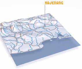 Places with similar names to Majenang, Indonesia ::
Disclaimer :: Information on this page comes without warranty of any kind |
||
|
Where is Majenang? Elevation and coordinates ::
Latitude (lat): 7°18'0"S Longitude (lon): 108°45'0"E
Elevation (approx.): 30m (map arrows pan, magnifying glasses zoom) |
||
|
Visiting Majenang? Hotel/Accommodation ::
Book a hotel in Majenang Travel Guide ::
Buy a travel guide for Indonesia rental cars ::
car rental offers GPS waypoint ::
download a GPX waypoint (PoI) of Majenang for your GPS receiver
|
||