|
search place name
|
||
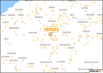
Mandas (Nusa Tenggara Timur, Indonesia)Mandas is a town in the Nusa Tenggara Timur region of Indonesia. An overview map of the region around Mandas is displayed below.
regional and 3d topo map of Mandas, Indonesia ::
Mandas airports ::
The nearest airport is DIL - Dili Presidente Nicolau Lobato Intl, located 94.9 km north east of Mandas.
Nearby towns ::
Loloa (0.5km north west) //
Tubakioan (0.8km south east) //
Kofeu (0.8km north) //
Tubaki (1.0km south west) //
Haliren (1.0km north west) //
Bestaesfehan (1.2km east) //
Asuulun (1.3km east) //
Nufuaf (1.4km south east) //
Talah (1.4km north west) //
Sukabiren (1.5km north) //
Motabuik (1.5km south east) //
Tini (1.7km north west) //
Tanahmerah (1.8km north) //
Lalosuk (1.8km east) //
Kotaren (2.0km north east) //
Bauatok (2.1km south east) //
Kampungbaru (2.3km north) //
Atambua (2.3km north) //
Weaituan (2.5km north west) //
Merdeka (2.5km north east) //
Wehali (2.5km north) //
Tala (2.5km west) //
Nitasren (2.6km north east) //
Fatubenau (2.7km north east) //
Weketiman (2.7km north west) //
Tatakiren (2.7km north) //
Wefau (2.9km north east) //
Wesrani (3.0km north) //
Tirlamalai (3.2km north) //
[all distances 'as the bird flies' and approximate] 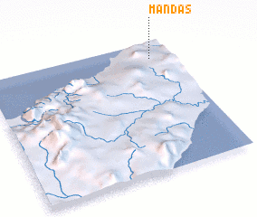 Places with similar names to Mandas, Indonesia ::
Disclaimer :: Information on this page comes without warranty of any kind |
||
|
Where is Mandas? Elevation and coordinates ::
Latitude (lat): 9°7'34"S Longitude (lon): 124°53'17"E
Elevation (approx.): 355m (map arrows pan, magnifying glasses zoom) |
||
|
Visiting Mandas? Hotel/Accommodation ::
Book a hotel in Mandas Travel Guide ::
Buy a travel guide for Indonesia rental cars ::
car rental offers GPS waypoint ::
download a GPX waypoint (PoI) of Mandas for your GPS receiver
|
||