|
search place name
|
||
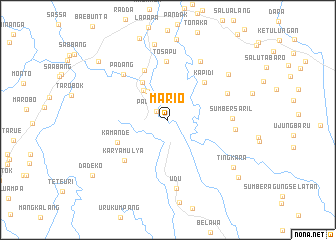
Mario (Sulawesi Selatan, Indonesia)Mario is a town in the Sulawesi Selatan region of Indonesia. An overview map of the region around Mario is displayed below.
regional and 3d topo map of Mario, Indonesia ::
Mario airports ::
The nearest airport is PSJ - Poso Kasiguncu, located 142.0 km north of Mario.
Other airports nearby include PLW - Palu Mutiara (198.6 km north), Nearby towns ::
Palandang (1.6km north west) //
Mariri (3.9km north west) //
Malinong (4.3km north west) //
Salulemo (5.1km north west) //
Kapidi (5.8km north east) //
Kuawu (6.1km north west) //
Kamande (6.1km south west) //
Tosapu (6.5km north) //
Karyamulya (6.7km south west) //
Padang (7.1km north west) //
Sumbersaril (7.2km east) //
Karyabakti (7.3km north east) //
Tarattallu (7.4km north east) //
Mangalle (7.6km east) //
Udu (7.7km south) //
Cendanaputih (8.4km north east) //
Lebannu (8.6km north) //
Tingkara (9.0km south east) //
Topao (10.2km south east) //
Kariango (10.2km north west) //
Dadeko (10.4km south west) //
[all distances 'as the bird flies' and approximate] 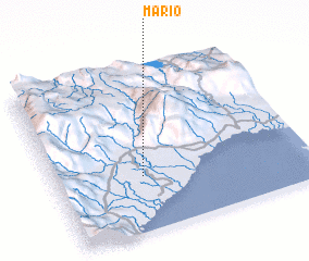 Places with similar names to Mario, Indonesia ::
Disclaimer :: Information on this page comes without warranty of any kind |
||
|
Where is Mario? Elevation and coordinates ::
Latitude (lat): 2°39'39"S Longitude (lon): 120°20'32"E
Elevation (approx.): 24m (map arrows pan, magnifying glasses zoom) |
||
|
Visiting Mario? Hotel/Accommodation ::
Book a hotel in Mario Travel Guide ::
Buy a travel guide for Indonesia rental cars ::
car rental offers GPS waypoint ::
download a GPX waypoint (PoI) of Mario for your GPS receiver
|
||