|
search place name
|
||
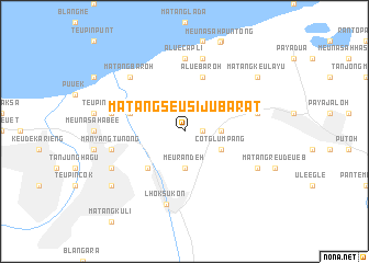
Matangseusiju-barat (Indonesia)Matangseusiju-barat is a town in Indonesia. An overview map of the region around Matangseusiju-barat is displayed below.
regional and 3d topo map of Matangseusiju-barat, Indonesia ::
Matangseusiju-barat airports ::
The nearest airport is BTJ - Banda Aceh Sultan Iskandarmuda, located 216.8 km west of Matangseusiju-barat.
Other airports nearby include MES - Medan Polonia (227.5 km south east), Nearby towns ::
Sampoiniet (1.8km east) //
Matangkareueng (3.7km east) //
Meurandeh (3.7km south) //
Cotglumpang (4.1km south east) //
Matangpanyang (4.1km south east) //
Cotglumpang (5.2km south west) //
Tanjongdama (5.8km west) //
Aluebaroh (5.9km north) //
Aluecapli (7.4km north) //
Teupingapeueh (7.6km west) //
Blangglumpang (7.6km north) //
Manyangtunong (7.6km west) //
Cotkumbang (7.6km east) //
Lingka-barat (7.6km east) //
Lhoksukon (7.6km south) //
Matangbaroh (7.8km north west) //
Bujok (8.3km south west) //
Blangsalet (8.3km south east) //
Blangjruen (9.2km south west) //
Matangkeulayu (9.2km north east) //
[all distances 'as the bird flies' and approximate] 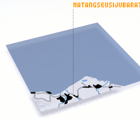 Places with similar names to Matangseusiju-barat, Indonesia :: Disclaimer :: Information on this page comes without warranty of any kind |
||
|
Where is Matangseusiju-barat? Elevation and coordinates ::
Latitude (lat): 5°7'0"N Longitude (lon): 97°20'0"E
Elevation (approx.): 4m (map arrows pan, magnifying glasses zoom) |
||
|
Visiting Matangseusiju-barat? Hotel/Accommodation ::
Book a hotel in Matangseusiju-barat Travel Guide ::
Buy a travel guide for Indonesia rental cars ::
car rental offers GPS waypoint ::
download a GPX waypoint (PoI) of Matangseusiju-barat for your GPS receiver
|
||