|
search place name
|
||
Nabo (Nusa Tenggara Timur, Indonesia)Nabo is a town in the Nusa Tenggara Timur region of Indonesia. An overview map of the region around Nabo is displayed below.
regional and 3d topo map of Nabo, Indonesia ::

Nabo airports ::
The nearest airport is DIL - Dili Presidente Nicolau Lobato Intl, located 135.3 km north east of Nabo.
Nearby towns ::
Beboraimeak (0.9km north west) //
Nekemale (0.9km north east) //
Kokaoon (1.6km north west) //
Koka (2.2km north east) //
Wekfau (2.3km north east) //
Numbei (2.5km south east) //
Kakaniuk A (2.9km south east) //
Kameko (2.9km north east) //
Aidois (3.1km west) //
Builaran (3.6km north east) //
Akaknotak (4.1km north east) //
Hahedan (4.2km south) //
Fatuknutuk C (4.3km north) //
Bekabu (4.3km north east) //
Bibokor (4.4km north west) //
Raimea 2 (4.4km west) //
Fatuknutuk B (4.5km north) //
Taekama (4.6km north west) //
Oebobana (4.7km north west) //
Laluan (4.7km south) //
Ninu (4.8km south) //
Harekaen (4.9km north east) //
Naibone (5.1km north) //
Tuenmaumoron (5.1km north west) //
Haeklese (5.2km south) //
Boni (5.2km south east) //
Oetfoh (5.3km west) //
Betara (5.4km east) //
Seneon (5.6km north) //
[all distances 'as the bird flies' and approximate] 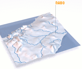 Places with similar names to Nabo, Indonesia ::
Disclaimer :: Information on this page comes without warranty of any kind |
||
|
Where is Nabo? Elevation and coordinates ::
Latitude (lat): 9°32'41"S Longitude (lon): 124°48'50"E
Elevation (approx.): 97m (map arrows pan, magnifying glasses zoom) |
||
|
Visiting Nabo? Hotel/Accommodation ::
Book a hotel in Nabo Travel Guide ::
Buy a travel guide for Indonesia rental cars ::
car rental offers GPS waypoint ::
download a GPX waypoint (PoI) of Nabo for your GPS receiver
|
||