|
search place name
|
||
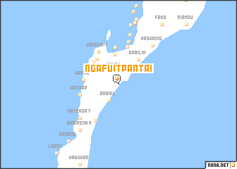
Ngafuitpantai (Maluku, Indonesia)Ngafuitpantai is a town in the Maluku region of Indonesia. An overview map of the region around Ngafuitpantai is displayed below.
regional and 3d topo map of Ngafuitpantai, Indonesia ::
Nearby towns ::
Yamtil (2.2km north) //
Ohoiel (3.0km south west) //
Raharin (4.8km north) //
Ohoilim (5.1km north east) //
Karkarit (5.3km north west) //
Lerohoilim (5.3km north west) //
Warka (5.6km west) //
Banda Elat (5.8km north) //
Waingirit (6.1km north west) //
Butun (6.1km north) //
Watuar (6.2km west) //
Ohoiwait (6.8km south west) //
Wakol (7.0km north) //
Ngudul (8.1km north) //
Matehoat (8.0km south west) //
Maswaing (8.3km north east) //
Ohoirenan (9.4km south west) //
[all distances 'as the bird flies' and approximate]  Places with similar names to Ngafuitpantai, Indonesia :: Disclaimer :: Information on this page comes without warranty of any kind |
||
|
Where is Ngafuitpantai? Elevation and coordinates ::
Latitude (lat): 5°42'8"S Longitude (lon): 132°59'16"E
Elevation (approx.): 128m (map arrows pan, magnifying glasses zoom) |
||
|
Visiting Ngafuitpantai? Hotel/Accommodation ::
Book a hotel in Ngafuitpantai Travel Guide ::
Buy a travel guide for Indonesia rental cars ::
car rental offers GPS waypoint ::
download a GPX waypoint (PoI) of Ngafuitpantai for your GPS receiver
|
||