|
search place name
|
||
Ngasinan (Indonesia)Ngasinan is a town in Indonesia. An overview map of the region around Ngasinan is displayed below.
regional and 3d topo map of Ngasinan, Indonesia ::
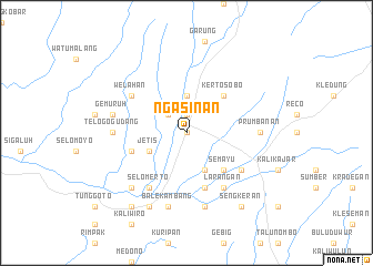
Nearby towns ::
Wonosobo (0.0km north) //
Kalianget (1.9km north) //
Kalitulang (2.6km north west) //
Kalibeber (3.7km north) //
Jetis (4.1km south west) //
Pagesangan (4.1km south east) //
Semayu (5.2km south east) //
Kertosobo (5.2km north east) //
Krasak (5.8km west) //
Kemranggen (5.9km south) //
Kerteg (6.6km south east) //
Larangan (6.7km south east) //
Selomerto (6.7km south west) //
Welahan (6.6km north west) //
Bedakah (7.4km east) //
Telogogudang (7.4km west) //
Prumbanan (7.4km east) //
Mungkung (7.6km south) //
Balekambang (7.6km south) //
Gemuruh (7.6km west) //
Leksono (7.8km south west) //
Krasak (8.3km south west) //
Sengkeran (9.2km south east) //
Selokromo (9.2km south west) //
[all distances 'as the bird flies' and approximate] 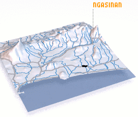
Disclaimer :: Information on this page comes without warranty of any kind |
||
|
Where is Ngasinan? Elevation and coordinates ::
Latitude (lat): 7°22'0"S Longitude (lon): 109°54'0"E
Elevation (approx.): 770m (map arrows pan, magnifying glasses zoom) |
||
|
Visiting Ngasinan? Hotel/Accommodation ::
Book a hotel in Ngasinan Travel Guide ::
Buy a travel guide for Indonesia rental cars ::
car rental offers GPS waypoint ::
download a GPX waypoint (PoI) of Ngasinan for your GPS receiver
|
||