|
search place name
|
||
Ngombol (Indonesia)Ngombol is a town in Indonesia. An overview map of the region around Ngombol is displayed below.
regional and 3d topo map of Ngombol, Indonesia ::

Nearby towns ::
Bubutan (2.6km north east) //
Guyangan (3.7km north) //
Karangjambu (3.7km east) //
Bejojo (3.7km east) //
Bukur (4.1km north west) //
Jogoboyo (4.1km south east) //
Tlogokotes (5.2km north east) //
Kuwojo (5.5km east) //
Wajamutihan (5.5km east) //
Congot (5.8km east) //
Purwodadi (5.9km north) //
Ngombol (6.7km north west) //
Ringgit (6.6km north west) //
Bagelen (6.7km north east) //
Jenar (7.4km north) //
Sindutan (7.6km east) //
Suwelo (7.8km north east) //
Sangon (8.2km north east) //
Wunut (9.2km north west) //
Setoyo (10.4km north east) //
[all distances 'as the bird flies' and approximate] 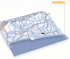 Places with similar names to Ngombol, Indonesia ::
Disclaimer :: Information on this page comes without warranty of any kind |
||
|
Where is Ngombol? Elevation and coordinates ::
Latitude (lat): 7°52'0"S Longitude (lon): 109°59'0"E
Elevation (approx.): 16m (map arrows pan, magnifying glasses zoom) |
||
|
Visiting Ngombol? Hotel/Accommodation ::
Book a hotel in Ngombol Travel Guide ::
Buy a travel guide for Indonesia rental cars ::
car rental offers GPS waypoint ::
download a GPX waypoint (PoI) of Ngombol for your GPS receiver
|
||