|
search place name
|
||
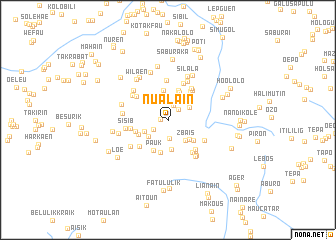
Nualain (Nusa Tenggara Timur, Indonesia)Nualain is a town in the Nusa Tenggara Timur region of Indonesia. An overview map of the region around Nualain is displayed below.
regional and 3d topo map of Nualain, Indonesia ::
Nualain airports ::
The nearest airport is DIL - Dili Presidente Nicolau Lobato Intl, located 76.4 km north east of Nualain.
Nearby towns ::
Ekintas (0.8km west) //
Duarato (1.7km north east) //
Leowalutas (1.8km north) //
Nokarwek (1.9km south west) //
Joikoi (2.0km south) //
Airawanteten (2.5km north west) //
Leowalu (2.6km north west) //
Lakus (2.8km north east) //
Lic (2.8km south west) //
Loonunatas (2.9km south west) //
Zbais (3.0km south east) //
Maligel (3.1km north east) //
Sabulmil (3.2km south east) //
Letoluan (3.3km south) //
Fulurtas (3.3km north) //
Holgotok (3.4km north) //
Fulur (3.5km north) //
Lakmaras (3.6km south east) //
Abateberai (3.7km south west) //
Pauk (3.7km south west) //
Kotasi (3.8km south) //
Kaukehi (3.8km west) //
Buarat a Balili (4.0km north east) //
Gumalolo (4.3km north east) //
Sisi A (4.2km west) //
Lakuuman (4.3km south west) //
Golpara (4.4km north) //
Weluli (4.4km north west) //
Sontoi (4.4km north east) //
[all distances 'as the bird flies' and approximate] 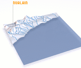 Places with similar names to Nualain, Indonesia ::
Disclaimer :: Information on this page comes without warranty of any kind |
||
|
Where is Nualain? Elevation and coordinates ::
Latitude (lat): 9°7'11"S Longitude (lon): 125°8'13"E
Elevation (approx.): 907m (map arrows pan, magnifying glasses zoom) |
||
|
Visiting Nualain? Hotel/Accommodation ::
Book a hotel in Nualain Travel Guide ::
Buy a travel guide for Indonesia rental cars ::
car rental offers GPS waypoint ::
download a GPX waypoint (PoI) of Nualain for your GPS receiver
|
||