|
search place name
|
||
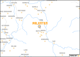
Palenten (Sulawesi Selatan, Indonesia)Palenten is a town in the Sulawesi Selatan region of Indonesia. An overview map of the region around Palenten is displayed below.
regional and 3d topo map of Palenten, Indonesia ::
Palenten airports ::
The nearest airport is PSJ - Poso Kasiguncu, located 207.6 km north of Palenten.
Other airports nearby include UPG - Ujung Pandang Hasanuddin (214.2 km south), Nearby towns ::
Anakdara (1.9km south) //
Buntu (2.2km south west) //
Barru (2.3km south east) //
Matarin (3.0km south) //
Taba (3.2km north) //
Tobuda (3.3km south) //
Beuma (3.7km south east) //
Tolong (3.7km south) //
Ambawang (6.4km south) //
Tosapang (6.8km north) //
Pantilang (7.5km north) //
Batualu (9.4km north west) //
Ojo (9.5km south east) //
Rantebua (11.4km north west) //
[all distances 'as the bird flies' and approximate] 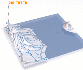 Places with similar names to Palenten, Indonesia ::
// Pollanden (DE)
// Pollanten (DE)
// Pallándion (GR)
// Plintiņi (LV)
// Pullentown (US)
// Palentown (US)
// Pullontown (US)
// Plantón (CR)
// Palantine (FR)
// Palindan (PH)
Disclaimer :: Information on this page comes without warranty of any kind |
||
|
Where is Palenten? Elevation and coordinates ::
Latitude (lat): 3°11'3"S Longitude (lon): 120°1'39"E
Elevation (approx.): 775m (map arrows pan, magnifying glasses zoom) |
||
|
Visiting Palenten? Hotel/Accommodation ::
Book a hotel in Palenten Travel Guide ::
Buy a travel guide for Indonesia rental cars ::
car rental offers GPS waypoint ::
download a GPX waypoint (PoI) of Palenten for your GPS receiver
|
||