|
search place name
|
||
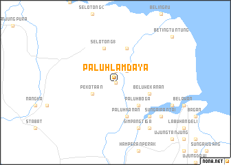
Paluhlamdaya (Indonesia)Paluhlamdaya is a town in Indonesia. An overview map of the region around Paluhlamdaya is displayed below.
regional and 3d topo map of Paluhlamdaya, Indonesia ::
Paluhlamdaya airports ::
The nearest airport is MES - Medan Polonia, located 30.2 km south of Paluhlamdaya.
Other airports nearby include PEN - Penang Intl (249.2 km north east), Nearby towns ::
Tangkahanmergat (0.0km north) //
Jabijabi (0.0km north) //
Tangkahanmeroau (1.9km north) //
Karanggading (2.6km north east) //
Pekotaan (4.1km south west) //
Paluhboga (5.2km south east) //
Paluboga (5.2km south east) //
Secanggang (5.9km north) //
Selotong 1 (5.9km north) //
Paluhmanan (5.9km south) //
Paluhdanau (5.9km north) //
Beluwe-kanan (5.8km east) //
Banjar 2 (7.9km south east) //
Paluhrimau (7.9km south east) //
Simpangtiga (8.3km south east) //
Paluh-besar (9.3km south east) //
Sungaipantai (9.3km south east) //
Banjar 3 (9.3km south east) //
[all distances 'as the bird flies' and approximate] 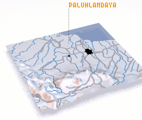 Places with similar names to Paluhlamdaya, Indonesia :: Disclaimer :: Information on this page comes without warranty of any kind |
||
|
Where is Paluhlamdaya? Elevation and coordinates ::
Latitude (lat): 3°49'0"N Longitude (lon): 98°35'0"E
Elevation (approx.): 3m (map arrows pan, magnifying glasses zoom) |
||
|
Visiting Paluhlamdaya? Hotel/Accommodation ::
Book a hotel in Paluhlamdaya Travel Guide ::
Buy a travel guide for Indonesia rental cars ::
car rental offers GPS waypoint ::
download a GPX waypoint (PoI) of Paluhlamdaya for your GPS receiver
|
||