|
search place name
|
||
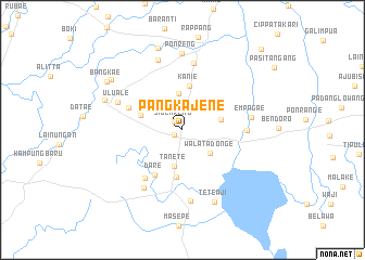
Pangkajene (Sulawesi Selatan, Indonesia)Pangkajene is a town in the Sulawesi Selatan region of Indonesia. An overview map of the region around Pangkajene is displayed below.
regional and 3d topo map of Pangkajene, Indonesia ::
Pangkajene airports ::
The nearest airport is UPG - Ujung Pandang Hasanuddin, located 128.4 km south of Pangkajene.
Nearby towns ::
Laulang (1.0km south west) //
Sidenreng (1.2km north west) //
Sereang (2.6km north) //
Walatadonge (3.7km south east) //
Pakenya (3.7km north) //
Tanete (3.8km south) //
Kanyuara (4.1km east) //
Kanie (4.6km north) //
Bilae (4.6km west) //
Allakuang (4.9km south) //
Dare (5.5km south west) //
Bojoe (5.9km west) //
Tepobatu (6.3km south west) //
Wattasalo (6.6km east) //
Kadidi (7.0km north) //
Telumae (7.1km south west) //
Empagae (7.2km east) //
Uluale (7.2km north west) //
Amparita (7.4km south) //
Manisa (7.6km north) //
Ponreng (7.9km north) //
Teteaji (8.1km south east) //
Lawawoi (8.5km west) //
Benteng (8.8km north) //
Todabojo (9.0km north west) //
Bangkae (9.2km north west) //
Bulukunyi (11.6km north east) //
[all distances 'as the bird flies' and approximate] 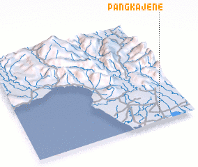 Places with similar names to Pangkajene, Indonesia ::
// Pangkajene (ID)
Disclaimer :: Information on this page comes without warranty of any kind |
||
|
Where is Pangkajene? Elevation and coordinates ::
Latitude (lat): 3°55'40"S Longitude (lon): 119°48'11"E
Elevation (approx.): 19m (map arrows pan, magnifying glasses zoom) |
||
|
Visiting Pangkajene? Hotel/Accommodation ::
Book a hotel in Pangkajene Travel Guide ::
Buy a travel guide for Indonesia rental cars ::
car rental offers GPS waypoint ::
download a GPX waypoint (PoI) of Pangkajene for your GPS receiver
|
||