|
search place name
|
||
Pangkalan (Indonesia)Pangkalan is a town in Indonesia. An overview map of the region around Pangkalan is displayed below.
regional and 3d topo map of Pangkalan, Indonesia ::
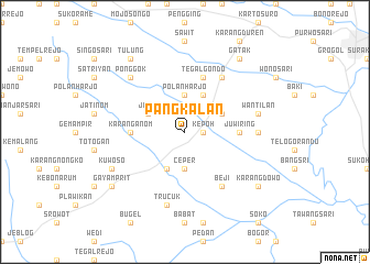
Nearby towns ::
Kepoh (1.8km east) //
Ceper (3.7km south) //
Polanharjo (3.7km north) //
Delanggu (4.1km north east) //
Ketandan (4.1km south west) //
Pundungan (4.1km north east) //
Tegalrejo (4.1km north west) //
Jetis (4.1km north west) //
Karanganom (5.5km west) //
Juwiring (5.5km east) //
Tegalgondo (5.9km north) //
Beji (6.7km south east) //
Sanggung (6.7km north east) //
Kwarasan (7.3km east) //
Wantilan (7.6km east) //
Trucuk (7.6km south) //
Ponggok (7.8km north west) //
Kuwoso (8.2km south west) //
Karangdowo (9.2km south east) //
Tulung (9.2km north west) //
Gayamprit (9.2km south west) //
Gatak (9.2km north east) //
[all distances 'as the bird flies' and approximate] 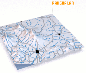 Places with similar names to Pangkalan, Indonesia ::
Disclaimer :: Information on this page comes without warranty of any kind |
||
|
Where is Pangkalan? Elevation and coordinates ::
Latitude (lat): 7°39'0"S Longitude (lon): 110°40'0"E
Elevation (approx.): 149m (map arrows pan, magnifying glasses zoom) |
||
|
Visiting Pangkalan? Hotel/Accommodation ::
Book a hotel in Pangkalan Travel Guide ::
Buy a travel guide for Indonesia rental cars ::
car rental offers GPS waypoint ::
download a GPX waypoint (PoI) of Pangkalan for your GPS receiver
|
||