|
search place name
|
||
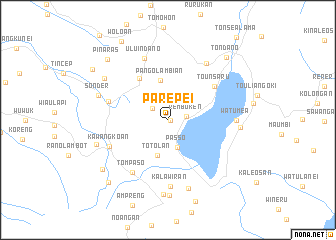
Parepei (Sulawesi Utara, Indonesia)Parepei is a town in the Sulawesi Utara region of Indonesia. An overview map of the region around Parepei is displayed below.
regional and 3d topo map of Parepei, Indonesia ::
Parepei airports ::
The nearest airport is MDC - Manado Sam Ratulangi, located 36.0 km north of Parepei.
Other airports nearby include GTO - Gorontalo Jalaluddin (231.9 km west), Nearby towns ::
Kaima (0.2km east) //
Remboken (2.1km east) //
Kuntung (2.2km north west) //
Passo (3.3km south) //
Tondangow (3.4km north west) //
Totolan (4.1km south) //
Pangolambian (4.5km north) //
Labendo (5.6km north west) //
Tounsaru (6.4km north east) //
Kalongan (7.0km west) //
Tompaso (7.1km south west) //
Kawangkoan (7.2km south west) //
Uluindano (7.3km north) //
Kalawiran (7.4km south) //
Tataaran (7.6km north east) //
Watumea (7.7km east) //
Kakas (7.9km south) //
Eris (8.1km east) //
Sonder (8.2km west) //
Langowan (8.3km south) //
Amongena (8.4km south) //
Rambunan (8.4km north west) //
Kayuwi (8.5km west) //
Ranowang (9.1km south west) //
Pinaras (9.5km north west) //
Tondano (9.6km north east) //
Watupina (9.6km south west) //
Sawangan (10.1km north west) //
Woloan (10.2km north west) //
[all distances 'as the bird flies' and approximate] 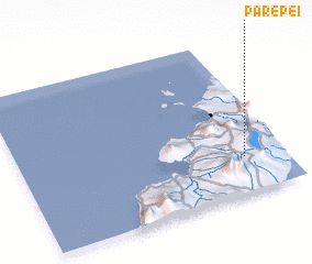 Places with similar names to Parepei, Indonesia ::
Disclaimer :: Information on this page comes without warranty of any kind |
||
|
Where is Parepei? Elevation and coordinates ::
Latitude (lat): 1°14'0"N Longitude (lon): 124°50'52"E
Elevation (approx.): 710m (map arrows pan, magnifying glasses zoom) |
||
|
Visiting Parepei? Hotel/Accommodation ::
Book a hotel in Parepei Travel Guide ::
Buy a travel guide for Indonesia rental cars ::
car rental offers GPS waypoint ::
download a GPX waypoint (PoI) of Parepei for your GPS receiver
|
||