|
search place name
|
||
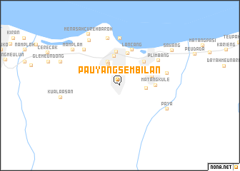
Pauyangsembilan (Indonesia)Pauyangsembilan is a town in Indonesia. An overview map of the region around Pauyangsembilan is displayed below.
regional and 3d topo map of Pauyangsembilan, Indonesia ::
Pauyangsembilan airports ::
The nearest airport is BTJ - Banda Aceh Sultan Iskandarmuda, located 124.8 km west of Pauyangsembilan.
Nearby towns ::
Meulinteung (1.9km north) //
Kutaruseb (2.6km north west) //
Lumpatan (2.6km north east) //
Menasah Keupula (2.7km north west) //
Menasah Teungoh (3.4km north west) //
Lhokdagang (3.8km north west) //
Lhokkulam (4.1km east) //
Cotleubeng (4.1km north west) //
Pandrah (4.1km north west) //
Bohpunt (4.1km north east) //
Lancokulim (4.7km north) //
Jeunieb (5.2km north) //
Matangnibang (5.2km north) //
Teupinpanah (5.3km east) //
Nalan (5.3km north east) //
Matangkule (5.5km east) //
Lancang (5.9km north) //
Plimbang (7.2km north east) //
Caluek (7.4km north) //
Alueteuhop (7.6km north) //
Jambo-dalam (7.6km east) //
Keude Tambo (7.8km north west) //
Paya (8.3km south east) //
Peuneulebaroh (8.6km north west) //
Mamplam (9.2km north west) //
Menasah Curehbaroh (9.4km north west) //
Sawang (9.7km north east) //
[all distances 'as the bird flies' and approximate] 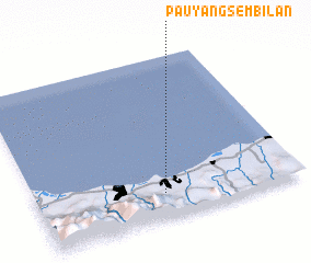 Places with similar names to Pauyangsembilan, Indonesia :: Disclaimer :: Information on this page comes without warranty of any kind |
||
|
Where is Pauyangsembilan? Elevation and coordinates ::
Latitude (lat): 5°9'0"N Longitude (lon): 96°29'0"E
Elevation (approx.): 18m (map arrows pan, magnifying glasses zoom) |
||
|
Visiting Pauyangsembilan? Hotel/Accommodation ::
Book a hotel in Pauyangsembilan Travel Guide ::
Buy a travel guide for Indonesia rental cars ::
car rental offers GPS waypoint ::
download a GPX waypoint (PoI) of Pauyangsembilan for your GPS receiver
|
||