|
search place name
|
||
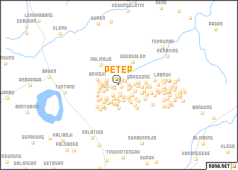
Petep (Jawa Tengah, Indonesia)Petep is a town in the Jawa Tengah region of Indonesia. An overview map of the region around Petep is displayed below.
regional and 3d topo map of Petep, Indonesia ::
Nearby towns ::
Dompon (0.5km south east) //
Brojodito (0.6km north) //
Popongan (0.9km south west) //
Dukuhsari (1.0km north east) //
Bantar (1.1km west) //
Doplang Satu (1.2km north east) //
Cikalan (1.2km south) //
Gendor (1.5km east) //
Prangkoan (1.6km east) //
Slemet (1.7km south) //
Dukuh (1.8km east) //
Ngasinan (1.9km south west) //
Karanglo (1.9km west) //
Gondanglegi (2.0km south) //
Bendosari (2.1km west) //
Senggrong (2.1km west) //
Klopo (2.1km west) //
Padaan (2.2km south) //
Karangguli (2.3km south) //
Gentan (2.3km west) //
Ngablak (2.5km south east) //
Plakaran (2.5km west) //
Baruan (2.5km south) //
Jatisari (2.5km east) //
Giling (2.6km south) //
Ngagrong (2.6km west) //
Carikan (2.6km south east) //
Gentan (2.6km east) //
Kadipiro (2.8km south west) //
[all distances 'as the bird flies' and approximate]  Places with similar names to Petep, Indonesia ::
Disclaimer :: Information on this page comes without warranty of any kind |
||
|
Where is Petep? Elevation and coordinates ::
Latitude (lat): 7°15'27"S Longitude (lon): 110°31'51"E
Elevation (approx.): 351m (map arrows pan, magnifying glasses zoom) |
||
|
Visiting Petep? Hotel/Accommodation ::
Book a hotel in Petep Travel Guide ::
Buy a travel guide for Indonesia rental cars ::
car rental offers GPS waypoint ::
download a GPX waypoint (PoI) of Petep for your GPS receiver
|
||