|
search place name
|
||
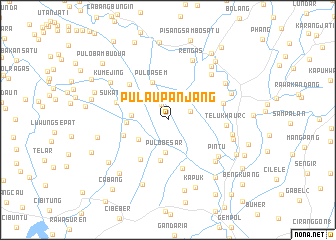
Pulaupanjang (Jawa Barat, Indonesia)Pulaupanjang is a town in the Jawa Barat region of Indonesia. An overview map of the region around Pulaupanjang is displayed below.
regional and 3d topo map of Pulaupanjang, Indonesia ::
Pulaupanjang airports ::
The nearest airport is CGK - Jakarta Soekarno Hatta Intl, located 62.6 km west of Pulaupanjang.
Nearby towns ::
Biuwo (1.9km north west) //
Rumbia (2.7km east) //
Pulo-besar (3.6km south) //
Pulaubambu Satu (3.9km south west) //
Serengseng (4.1km west) //
Puloasem (4.5km north) //
Peundeuy (4.6km south) //
Belokang (4.6km west) //
Kobakbuaya (5.2km west) //
Pule 1 (5.3km south west) //
Lemahabang (5.7km south) //
Gamprit Dua (5.8km north west) //
Kertasari (6.0km north east) //
Sukatani (6.1km west) //
Bojong (6.4km east) //
Telukhaur 2 (6.5km east) //
Pintu (6.9km south east) //
Pebayurah (7.0km south east) //
Pacina (7.1km north east) //
Rengas (7.2km north) //
Teko (7.3km east) //
Putaruman 2 (7.6km east) //
Tegalpacina (7.6km north east) //
Cicindet (7.7km north east) //
Kumejing (7.7km north west) //
Glonggong (7.7km south) //
Rengasdengklok (7.7km north east) //
Plaukan (8.0km south west) //
Rawakuda (8.1km south) //
[all distances 'as the bird flies' and approximate] 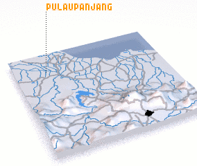 Places with similar names to Pulaupanjang, Indonesia ::
Disclaimer :: Information on this page comes without warranty of any kind |
||
|
Where is Pulaupanjang? Elevation and coordinates ::
Latitude (lat): 6°10'31"S Longitude (lon): 107°13'9"E
Elevation (approx.): 13m (map arrows pan, magnifying glasses zoom) |
||
|
Visiting Pulaupanjang? Hotel/Accommodation ::
Book a hotel in Pulaupanjang Travel Guide ::
Buy a travel guide for Indonesia rental cars ::
car rental offers GPS waypoint ::
download a GPX waypoint (PoI) of Pulaupanjang for your GPS receiver
|
||