|
search place name
|
||
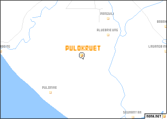
Pulo Kruet (Indonesia)Pulo Kruet is a town in Indonesia. An overview map of the region around Pulo Kruet is displayed below.
regional and 3d topo map of Pulo Kruet, Indonesia ::
Pulo Kruet airports ::
The nearest airport is BTJ - Banda Aceh Sultan Iskandarmuda, located 220.9 km north west of Pulo Kruet.
Nearby towns ::
Alue Brieung (7.9km north east) //
Pulo Rime (10.5km south west) //
[all distances 'as the bird flies' and approximate] 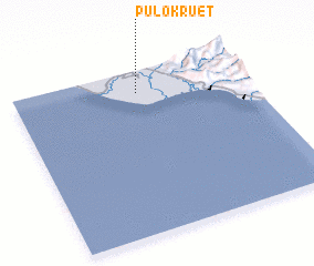 Places with similar names to Pulo Kruet, Indonesia ::
// Polgárdi (HU)
// Polgárdi (HU)
// Palo Gordo (CU)
// Polk Road (US)
// Palo Gordo (CO)
// Palogordo (CO)
// Palogordo (CO)
// Polokarto (ID)
// Paligrad (MK)
// Palo Gordo (MX)
Disclaimer :: Information on this page comes without warranty of any kind |
||
|
Where is Pulo Kruet? Elevation and coordinates ::
Latitude (lat): 3°52'0"N Longitude (lon): 96°32'0"E
Elevation (approx.): 37m (map arrows pan, magnifying glasses zoom) |
||
|
Visiting Pulo Kruet? Hotel/Accommodation ::
Book a hotel in Pulo Kruet Travel Guide ::
Buy a travel guide for Indonesia rental cars ::
car rental offers GPS waypoint ::
download a GPX waypoint (PoI) of Pulo Kruet for your GPS receiver
|
||