|
search place name
|
||
Ranteliang (Indonesia)Ranteliang is a town in Indonesia. An overview map of the region around Ranteliang is displayed below.
regional and 3d topo map of Ranteliang, Indonesia ::

Ranteliang airports ::
The nearest airport is PSJ - Poso Kasiguncu, located 228.8 km north east of Ranteliang.
Nearby towns ::
Neamba (2.1km north west) //
Pambe (3.0km north east) //
Ballapeu (4.4km west) //
Balineu (4.4km west) //
Orong (5.2km north east) //
Malabo (5.2km south west) //
Orabua (5.9km east) //
Osango (6.3km north east) //
Balambang (6.5km south west) //
Tondokbakaro (7.0km west) //
Mamasa (7.2km north east) //
Tamalanti (7.7km south) //
Sepang (8.9km east) //
Bunlurea (9.2km north east) //
Kole (9.9km north east) //
[all distances 'as the bird flies' and approximate] 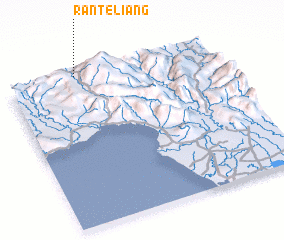
Disclaimer :: Information on this page comes without warranty of any kind |
||
|
Where is Ranteliang? Elevation and coordinates ::
Latitude (lat): 3°0'0"S Longitude (lon): 119°20'0"E
Elevation (approx.): 1041m (map arrows pan, magnifying glasses zoom) |
||
|
Visiting Ranteliang? Hotel/Accommodation ::
Book a hotel in Ranteliang Travel Guide ::
Buy a travel guide for Indonesia rental cars ::
car rental offers GPS waypoint ::
download a GPX waypoint (PoI) of Ranteliang for your GPS receiver
|
||