|
search place name
|
||
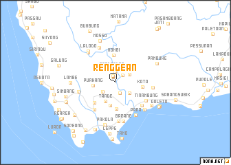
Renggean (Sulawesi Selatan, Indonesia)Renggean is a town in the Sulawesi Selatan region of Indonesia. An overview map of the region around Renggean is displayed below.
regional and 3d topo map of Renggean, Indonesia ::
Renggean airports ::
The nearest airport is UPG - Ujung Pandang Hasanuddin, located 186.1 km south of Renggean.
Nearby towns ::
Saluna (1.2km north) //
Kalelo (1.6km north) //
Napo (1.7km north east) //
Lena (1.8km south east) //
Tandasura (2.2km north) //
Pupenga (2.6km south west) //
Teppo (2.6km north east) //
Labarang (2.8km south east) //
Tande (3.5km south west) //
Puawang (3.7km west) //
Batu (3.8km south) //
Kaloli (4.3km south) //
Kota (4.4km east) //
Mombi (4.5km north) //
Lembang (4.8km south west) //
Silombo (5.6km south west) //
Gade (5.7km south east) //
Tinambung (5.8km south east) //
Balanipa (6.1km east) //
Pallarangan (6.1km west) //
Arabunan (6.2km north west) //
Para (6.2km south east) //
Lutan (6.3km south) //
Barane (6.4km south) //
Monjopai (6.5km south east) //
Paroppo (6.6km north west) //
Lalodo (6.7km north west) //
Karama (7.0km south east) //
Pakola (7.1km south) //
[all distances 'as the bird flies' and approximate] 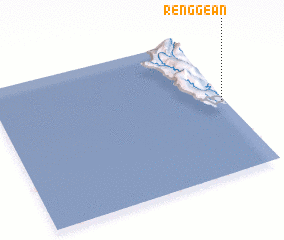 Places with similar names to Renggean, Indonesia ::
Disclaimer :: Information on this page comes without warranty of any kind |
||
|
Where is Renggean? Elevation and coordinates ::
Latitude (lat): 3°28'39"S Longitude (lon): 118°59'21"E
Elevation (approx.): 44m (map arrows pan, magnifying glasses zoom) |
||
|
Visiting Renggean? Hotel/Accommodation ::
Book a hotel in Renggean Travel Guide ::
Buy a travel guide for Indonesia rental cars ::
car rental offers GPS waypoint ::
download a GPX waypoint (PoI) of Renggean for your GPS receiver
|
||