|
search place name
|
||
Sangkurio (Sulawesi Selatan, Indonesia)Sangkurio is a town in the Sulawesi Selatan region of Indonesia. An overview map of the region around Sangkurio is displayed below.
regional and 3d topo map of Sangkurio, Indonesia ::

Sangkurio airports ::
The nearest airport is PLW - Palu Mutiara, located 224.7 km north east of Sangkurio.
Other airports nearby include PSJ - Poso Kasiguncu (239.6 km north east), Nearby towns ::
Danga (1.0km west) //
Tambi (1.3km north west) //
Mamuju (2.1km west) //
Kelapatujuh (2.4km south) //
Padangbaka (2.5km west) //
Kasiwa (2.8km north west) //
Tammasapi (3.0km south east) //
Bayorbayor (3.1km north east) //
Tumuki (3.1km north east) //
Rimuku (3.9km west) //
Salutalawar (4.3km north east) //
Karema (4.9km west) //
Karaeang (5.0km north west) //
Salulullung (5.2km south) //
Simbuang (5.3km west) //
Simboro (5.3km west) //
Saluppangi (5.8km west) //
Patidi (6.2km south west) //
Bajak (6.4km north) //
Takaurang (6.4km south east) //
Karampuang (6.5km north west) //
Gimbang (6.8km west) //
Bonebone (7.0km north east) //
Tallang (7.1km north west) //
Sese (7.3km west) //
Sepang (7.6km north) //
Botteng (7.8km south west) //
Salupalli (7.8km west) //
Manalisse (8.0km north east) //
[all distances 'as the bird flies' and approximate] 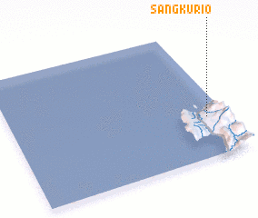 Places with similar names to Sangkurio, Indonesia ::
// Sungai Keruh (MY)
// Sangkoro (BJ)
// Sangkari (BT)
// Sungaiakar (ID)
// Sungaiakar (ID)
// Sang Kar (IR)
// Zoungokro (CI)
Disclaimer :: Information on this page comes without warranty of any kind |
||
|
Where is Sangkurio? Elevation and coordinates ::
Latitude (lat): 2°41'6"S Longitude (lon): 118°54'41"E
Elevation (approx.): 30m (map arrows pan, magnifying glasses zoom) |
||
|
Visiting Sangkurio? Hotel/Accommodation ::
Book a hotel in Sangkurio Travel Guide ::
Buy a travel guide for Indonesia rental cars ::
car rental offers GPS waypoint ::
download a GPX waypoint (PoI) of Sangkurio for your GPS receiver
|
||