|
search place name
|
||
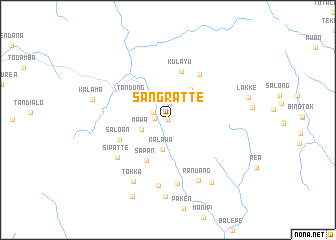
Sangratte (Sulawesi Selatan, Indonesia)Sangratte is a town in the Sulawesi Selatan region of Indonesia. An overview map of the region around Sangratte is displayed below.
regional and 3d topo map of Sangratte, Indonesia ::
Sangratte airports ::
The nearest airport is PSJ - Poso Kasiguncu, located 211.9 km north east of Sangratte.
Nearby towns ::
Sangraue (0.0km north west) //
Mawa (1.5km west) //
Meku (1.8km north west) //
Patambunan (1.9km north) //
Paurrungan (2.4km north) //
Mawa (3.1km west) //
Kalawa (3.4km south) //
Pollo (4.2km north east) //
Tandung (4.7km north west) //
Ladi (4.7km north west) //
Sapan (5.1km south west) //
Kulayu (5.7km north) //
Saloan (5.8km west) //
Bulangi (6.2km north east) //
Sipatte (7.1km south west) //
Karaka (7.1km south) //
Karoan (7.4km south) //
Ranuang (7.6km south east) //
Tokka (7.9km south west) //
Rada (8.6km south east) //
Panna (8.6km south) //
Kalama (8.7km west) //
Pana (9.5km south west) //
[all distances 'as the bird flies' and approximate]  Places with similar names to Sangratte, Indonesia ::
Disclaimer :: Information on this page comes without warranty of any kind |
||
|
Where is Sangratte? Elevation and coordinates ::
Latitude (lat): 2°59'22"S Longitude (lon): 119°34'8"E
Elevation (approx.): 659m (map arrows pan, magnifying glasses zoom) |
||
|
Visiting Sangratte? Hotel/Accommodation ::
Book a hotel in Sangratte Travel Guide ::
Buy a travel guide for Indonesia rental cars ::
car rental offers GPS waypoint ::
download a GPX waypoint (PoI) of Sangratte for your GPS receiver
|
||