|
search place name
|
||
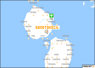
Sanoto-kecil (Indonesia)Sanoto-kecil is a town in Indonesia. An overview map of the region around Sanoto-kecil is displayed below.
regional and 3d topo map of Sanoto-kecil, Indonesia ::
Sanoto-kecil airports ::
The nearest airport is TTE - Ternate Sultan Babullah, located 7.3 km north of Sanoto-kecil.
Other airports nearby include OTI - Morotai Island Pitu (177.1 km north east), Nearby towns ::
Buku Konora (1.9km north) //
Marikrubu (1.9km north) //
Kota Baru (1.9km east) //
Toboko (1.9km east) //
Kalapapende (1.9km east) //
Uboubo (1.9km south) //
Fitu (2.6km south west) //
Tobona (2.6km south west) //
Kalumata (2.6km south west) //
Siko (3.7km north) //
Kailupa (3.7km south) //
Dufa Dufa (4.1km north east) //
Toboleo (4.1km north east) //
Ake Turi (4.1km south east) //
Ternate (5.2km north east) //
Cobo (5.2km south east) //
Tubo (5.6km north) //
Pasimayou (5.6km south) //
Sarimuli (5.6km south) //
Nyaremadu (5.6km south) //
Tofure (5.9km north) //
Tabam (5.9km north) //
Sango (5.9km north) //
Rum (5.9km south) //
Pipa (5.9km south) //
Castela (5.9km west) //
Amo (5.9km west) //
Baturaja (5.9km west) //
Jambula (5.9km west) //
[all distances 'as the bird flies' and approximate]  Places with similar names to Sanoto-kecil, Indonesia ::
// Sanda-Kizulu (CD)
Disclaimer :: Information on this page comes without warranty of any kind |
||
|
Where is Sanoto-kecil? Elevation and coordinates ::
Latitude (lat): 0°46'0"S Longitude (lon): 127°22'0"E
Elevation (approx.): 22m (map arrows pan, magnifying glasses zoom) |
||
|
Visiting Sanoto-kecil? Hotel/Accommodation ::
Book a hotel in Sanoto-kecil Travel Guide ::
Buy a travel guide for Indonesia rental cars ::
car rental offers GPS waypoint ::
download a GPX waypoint (PoI) of Sanoto-kecil for your GPS receiver
|
||