|
search place name
|
||
Sukaerlaku (Nusa Tenggara Timur, Indonesia)Sukaerlaku is a town in the Nusa Tenggara Timur region of Indonesia. An overview map of the region around Sukaerlaku is displayed below.
regional and 3d topo map of Sukaerlaku, Indonesia ::

Sukaerlaku airports ::
The nearest airport is DIL - Dili Presidente Nicolau Lobato Intl, located 134.9 km north east of Sukaerlaku.
Nearby towns ::
Sukaerlaku (0.1km north west) //
Kotafoun (0.2km west) //
Motaain (0.2km north) //
Motaain (0.3km north) //
Kotafoun (0.3km west) //
Alastasi (0.4km south west) //
Alastasi (0.4km south west) //
Loosina (1.1km north) //
Fahiluka (1.1km north west) //
Wedare (1.2km north) //
Nataraen (1.3km north west) //
Naekasak (1.3km north) //
Latan (1.5km north west) //
Tetobane (1.6km north) //
Maneken (2.0km north west) //
Bakae (2.2km north) //
Laento (2.2km north west) //
Busabelo (2.2km west) //
Kabukalaran (2.5km north east) //
Misi (2.5km north) //
Tuikuor (2.6km north) //
Airae (2.6km west) //
Sukabilulik (2.7km north west) //
Bolan (2.7km north) //
Lainsukaen (2.8km north) //
Manumutibrubit (2.7km north west) //
Airae (2.7km west) //
Lelor (2.8km north west) //
Pelita B (3.0km north west) //
[all distances 'as the bird flies' and approximate] 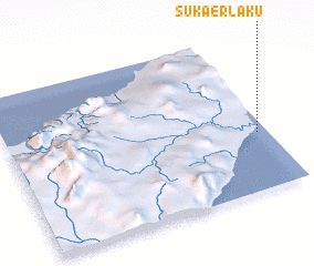 Places with similar names to Sukaerlaku, Indonesia ::
// Schärlig (CH)
// Scharleuk (DE)
// Skourlaíika (GR)
// Sakarıılıca (TR)
// Sugar Lake (US)
// Sugar Lake (US)
// Scurlock (US)
// Sukaerlaku (ID)
Disclaimer :: Information on this page comes without warranty of any kind |
||
|
Where is Sukaerlaku? Elevation and coordinates ::
Latitude (lat): 9°37'54"S Longitude (lon): 124°57'51"E
Elevation (approx.): 1m (map arrows pan, magnifying glasses zoom) |
||
|
Visiting Sukaerlaku? Hotel/Accommodation ::
Book a hotel in Sukaerlaku Travel Guide ::
Buy a travel guide for Indonesia rental cars ::
car rental offers GPS waypoint ::
download a GPX waypoint (PoI) of Sukaerlaku for your GPS receiver
|
||