|
search place name
|
||
Sukaraja (Indonesia)Sukaraja is a town in Indonesia. An overview map of the region around Sukaraja is displayed below.
regional and 3d topo map of Sukaraja, Indonesia ::

Sukaraja airports ::
The nearest airport is CGK - Jakarta Soekarno Hatta Intl, located 41.9 km east of Sukaraja.
Nearby towns ::
Babakan (1.6km north) //
Pasirmuncang (2.0km north west) //
Pangawinan (2.9km south east) //
Pamarayan (4.1km south) //
Babakan Malanggan (5.4km south west) //
Cipinang (5.4km south east) //
Junti (5.4km south east) //
Cikeusal (5.4km west) //
Binung (5.5km south east) //
Cikande (5.7km east) //
Kedunglaban (5.7km north east) //
Mongpok (5.8km north west) //
Kramat (6.5km north) //
Pematang (7.0km north west) //
Raab (7.0km north east) //
Plembangan (7.1km north) //
Jalajat (7.1km south) //
Curug (7.3km north east) //
Gorda (7.4km north east) //
Maracang (7.5km north) //
Jambu (7.5km south) //
Harendong (7.6km south east) //
Kareo (7.7km east) //
Ciroke (7.9km north east) //
Banjar (7.9km east) //
Lemahabang (8.2km west) //
Tambak (8.2km north) //
Ciwangen (8.3km south east) //
Cikande-hilir (8.5km east) //
[all distances 'as the bird flies' and approximate] 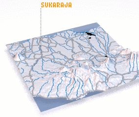 Places with similar names to Sukaraja, Indonesia ::
// Skyridge (US)
// Sugar Ridge (US)
// Sagrejá (PA)
// Sakurgi (EE)
// Sao Corojo (CU)
// Skuraj (AL)
// Čigrije (BA)
// Zagorje (BA)
// Zagorje (BA)
// Zagorje (BA)
Disclaimer :: Information on this page comes without warranty of any kind |
||
|
Where is Sukaraja? Elevation and coordinates ::
Latitude (lat): 6°13'28"S Longitude (lon): 106°17'24"E
Elevation (approx.): 17m (map arrows pan, magnifying glasses zoom) |
||
|
Visiting Sukaraja? Hotel/Accommodation ::
Book a hotel in Sukaraja Travel Guide ::
Buy a travel guide for Indonesia rental cars ::
car rental offers GPS waypoint ::
download a GPX waypoint (PoI) of Sukaraja for your GPS receiver
|
||