|
search place name
|
||
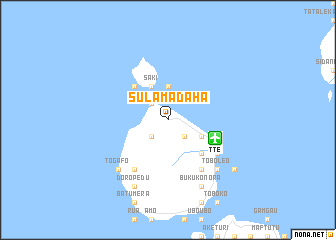
Sulamadaha (Indonesia)Sulamadaha is a town in Indonesia. An overview map of the region around Sulamadaha is displayed below.
regional and 3d topo map of Sulamadaha, Indonesia ::
Sulamadaha airports ::
The nearest airport is TTE - Ternate Sultan Babullah, located 5.7 km east of Sulamadaha.
Other airports nearby include OTI - Morotai Island Pitu (172.2 km north east), Nearby towns ::
Takome (2.6km south west) //
Tafraka (2.6km north west) //
Dorariisa (2.6km north west) //
Kulaba (2.6km south east) //
Tabalo (2.6km south east) //
Mado (3.7km north) //
Saki (4.1km north west) //
Tarau (4.1km south east) //
Kao Cina (5.2km north west) //
Tubo (5.2km south east) //
Tabam (6.7km south east) //
Tofure (6.7km south east) //
Sango (6.7km south east) //
Afe (6.7km south west) //
Banedinga (6.7km south west) //
Loto (6.7km south west) //
Siko (6.7km south east) //
Dufa Dufa (7.9km south east) //
Toboleo (7.9km south east) //
Togafo (7.9km south west) //
Doropedu (8.3km south west) //
Taduma (8.3km south west) //
Buku Konora (8.3km south east) //
Marikrubu (8.3km south east) //
Ternate (9.3km south east) //
[all distances 'as the bird flies' and approximate] 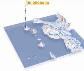 Places with similar names to Sulamadaha, Indonesia :: Disclaimer :: Information on this page comes without warranty of any kind |
||
|
Where is Sulamadaha? Elevation and coordinates ::
Latitude (lat): 0°51'0"S Longitude (lon): 127°20'0"E
Elevation (approx.): 99m (map arrows pan, magnifying glasses zoom) |
||
|
Visiting Sulamadaha? Hotel/Accommodation ::
Book a hotel in Sulamadaha Travel Guide ::
Buy a travel guide for Indonesia rental cars ::
car rental offers GPS waypoint ::
download a GPX waypoint (PoI) of Sulamadaha for your GPS receiver
|
||