|
search place name
|
||
Sumberagung (Sulawesi Selatan, Indonesia)Sumberagung is a town in the Sulawesi Selatan region of Indonesia. An overview map of the region around Sumberagung is displayed below.
regional and 3d topo map of Sumberagung, Indonesia ::

Sumberagung airports ::
The nearest airport is PSJ - Poso Kasiguncu, located 142.1 km north of Sumberagung.
Other airports nearby include PLW - Palu Mutiara (203.6 km north), Nearby towns ::
Sumberwangi (0.4km north) //
Mangalle (3.0km north west) //
Ujungsari (3.8km east) //
Ujungbaru (3.9km east) //
Sumbersaril (4.0km north west) //
Tingkara (4.1km south west) //
Topao (4.6km south west) //
Muktisari (5.2km north east) //
Sukamukti (5.4km north) //
Sidoharjo (5.9km north east) //
Sukaharapan (6.1km north) //
Karyabakti (6.5km north west) //
Sumberagung Selatan (6.6km south east) //
Waeluwo (6.7km north) //
Coppabattatana (7.1km east) //
Tolangi (7.3km north east) //
Transal (7.3km south) //
Mataram (8.0km north east) //
Cendanaputih (8.3km north west) //
Salutabaro (8.3km north) //
Kapidi (9.0km north west) //
Sukamaju (9.1km north) //
Makitta (9.3km south east) //
Harapan (9.3km north east) //
Kambisa (10.6km south west) //
Tarattallu (11.1km north west) //
[all distances 'as the bird flies' and approximate] 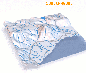 Places with similar names to Sumberagung, Indonesia ::
// Sumberagung (ID)
// Sumberagung (ID)
// Sumberagung (ID)
// Sumberagung (ID)
// Sumberagung (ID)
// Sumuragung (ID)
Disclaimer :: Information on this page comes without warranty of any kind |
||
|
Where is Sumberagung? Elevation and coordinates ::
Latitude (lat): 2°40'57"S Longitude (lon): 120°26'4"E
Elevation (approx.): 14m (map arrows pan, magnifying glasses zoom) |
||
|
Visiting Sumberagung? Hotel/Accommodation ::
Book a hotel in Sumberagung Travel Guide ::
Buy a travel guide for Indonesia rental cars ::
car rental offers GPS waypoint ::
download a GPX waypoint (PoI) of Sumberagung for your GPS receiver
|
||