|
search place name
|
||
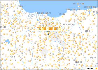
Tanahabang (Indonesia)Tanahabang is a town in Indonesia. An overview map of the region around Tanahabang is displayed below.
regional and 3d topo map of Tanahabang, Indonesia ::
Tanahabang airports ::
The nearest airport is CGK - Jakarta Soekarno Hatta Intl, located 18.7 km west of Tanahabang.
Nearby towns ::
Pejambon (0.2km south east) //
Kebonsirth (0.2km south east) //
Tanah Rendah (0.2km south) //
Kampungrima (0.5km south) //
Sabangan (0.8km north) //
Kebonkacang (0.9km south) //
Kebonjae (0.9km north) //
Ancek (1.0km west) //
Pulo (1.1km west) //
Gambir (1.2km east) //
Petojo Udik (1.3km north) //
Petojo (1.6km north) //
Jati (1.6km south west) //
Kolabambu (1.7km west) //
Gondangdia (1.7km south east) //
Glongbaru (1.7km west) //
Jakarta (1.8km north east) //
Kober (1.8km south west) //
Pasarmanggis (2.0km south) //
Cideng-baru (2.0km south) //
Kebonmanggis (2.0km west) //
Dongkelan (2.0km east) //
Ketopang (2.0km east) //
Jalipulo (2.1km north west) //
Kebonklapa (2.2km north) //
Pelamburan (2.2km south west) //
Slipi (2.3km south west) //
Petamburan (2.3km south west) //
Pecenongan (2.4km north east) //
[all distances 'as the bird flies' and approximate] 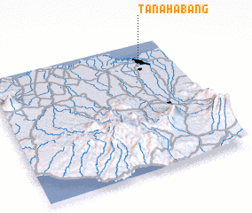 Places with similar names to Tanahabang, Indonesia ::
Disclaimer :: Information on this page comes without warranty of any kind |
||
|
Where is Tanahabang? Elevation and coordinates ::
Latitude (lat): 6°10'55"S Longitude (lon): 106°48'54"E
Elevation (approx.): 4m (map arrows pan, magnifying glasses zoom) |
||
|
Visiting Tanahabang? Hotel/Accommodation ::
Book a hotel in Tanahabang Travel Guide ::
Buy a travel guide for Indonesia rental cars ::
car rental offers GPS waypoint ::
download a GPX waypoint (PoI) of Tanahabang for your GPS receiver
|
||