|
search place name
|
||
Tanahbaru (Indonesia)Tanahbaru is a town in Indonesia. An overview map of the region around Tanahbaru is displayed below.
regional and 3d topo map of Tanahbaru, Indonesia ::

Tanahbaru airports ::
The nearest airport is CGK - Jakarta Soekarno Hatta Intl, located 37.2 km west of Tanahbaru.
Nearby towns ::
Bojongkaratom (0.6km south east) //
Poncolutan (0.7km west) //
Sungaiatep (1.0km west) //
Bali (1.0km south) //
Sungaitirem (1.0km west) //
Palbaru (1.1km north west) //
Poncol (1.3km west) //
Pal (1.5km north) //
Pangkalan (1.8km north west) //
Gadungan (1.8km north west) //
Kebonkelapa (2.2km north east) //
Tikungan (2.3km east) //
Cikedung (2.3km south west) //
Tambun-taianjing (2.3km south west) //
Tambun-sungaiangke (2.5km south east) //
Sungaibambu (2.5km south west) //
Sungaitawar (2.5km north) //
Pomahan (2.7km south) //
Kelapa (2.7km east) //
Bojong (2.8km east) //
Bambukuning (3.0km west) //
Pisangbatu (3.1km south) //
Bidara (3.2km west) //
Tambun (3.3km south east) //
Karatan (3.4km east) //
Telar (3.4km north east) //
Palbusuk (3.6km north) //
Tambun (3.7km east) //
Sungaikendal (3.7km south west) //
[all distances 'as the bird flies' and approximate] 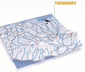 Places with similar names to Tanahbaru, Indonesia ::
Disclaimer :: Information on this page comes without warranty of any kind |
||
|
Where is Tanahbaru? Elevation and coordinates ::
Latitude (lat): 6°6'51"S Longitude (lon): 106°59'30"E
Elevation (approx.): 2m (map arrows pan, magnifying glasses zoom) |
||
|
Visiting Tanahbaru? Hotel/Accommodation ::
Book a hotel in Tanahbaru Travel Guide ::
Buy a travel guide for Indonesia rental cars ::
car rental offers GPS waypoint ::
download a GPX waypoint (PoI) of Tanahbaru for your GPS receiver
|
||