|
search place name
|
||
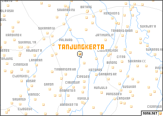
Tanjungkerta (Indonesia)Tanjungkerta is a town in Indonesia. An overview map of the region around Tanjungkerta is displayed below.
regional and 3d topo map of Tanjungkerta, Indonesia ::
Tanjungkerta airports ::
The nearest airport is CGK - Jakarta Soekarno Hatta Intl, located 122.1 km west of Tanjungkerta.
Nearby towns ::
Pasirmuncang (1.4km south east) //
Tanjungsari (3.3km east) //
Palawad (4.6km north west) //
Katamas (5.1km south east) //
Timbarigrawa (5.2km south west) //
Cipedes (5.5km south) //
Tanjongan (5.9km west) //
Cibarengkok (6.2km east) //
Lamaran 2 (6.6km north) //
Pasirbungur (6.6km south west) //
Kedindi (6.7km east) //
Cikaum-hilir (6.8km south) //
Rancabango (6.8km west) //
Jatimurilit (6.9km north east) //
Cibungur (7.0km south) //
Dukuh (7.0km north) //
Sengon (7.2km north west) //
Layapan (7.4km south west) //
Binong (7.5km east) //
Sindangsari (7.9km south) //
Gambarsar (7.9km south east) //
Purwodadi (8.3km south west) //
Dukuhgirang (8.4km north west) //
Babakan Sumur (8.4km east) //
Curukbadak (8.4km north) //
Ciasem (8.8km north west) //
Prapatan (9.1km south) //
Munjul 1 (9.2km south east) //
Gempolsari (9.6km north west) //
[all distances 'as the bird flies' and approximate]  Places with similar names to Tanjungkerta, Indonesia ::
// Tanjungkerta (ID)
// Tanjungkerta (ID)
Disclaimer :: Information on this page comes without warranty of any kind |
||
|
Where is Tanjungkerta? Elevation and coordinates ::
Latitude (lat): 6°23'21"S Longitude (lon): 107°43'40"E
Elevation (approx.): 17m (map arrows pan, magnifying glasses zoom) |
||
|
Visiting Tanjungkerta? Hotel/Accommodation ::
Book a hotel in Tanjungkerta Travel Guide ::
Buy a travel guide for Indonesia rental cars ::
car rental offers GPS waypoint ::
download a GPX waypoint (PoI) of Tanjungkerta for your GPS receiver
|
||